1950s Maps of Bixby, Oklahoma
Explore 6 historic maps of Bixby from the 1950s. These maps offer a rare glimpse into what life looked like during the 1950s — showing old roads, neighborhoods, homes, and landmarks that have changed or disappeared over time.
Whether you're researching your family's past, planning a metal detecting trip, or studying how Bixby's landscape evolved across the 1950s, these high-resolution maps are a powerful tool for exploring the history of this region.
- Focus on a specific era: All maps on this page are from the 1950s, giving you a focused view of this time period.
- See what’s changed: Compare century-old streets, trails, and buildings to today's modern landscape using overlays and satellite layers.
- Research with precision: Use these maps for genealogy, historical research, land use analysis, or educational projects.
- View, download, or print: Maps are fully viewable online in high resolution, and can be downloaded or printed for your own records.
Start exploring Bixby's history through authentic maps from the 1950s. This is your window into the past.
Bixby, OK maps
(6)- 1952 Map of Jenks, 1953 Print
 1952 Jenks1953 Print · USGSThe riverfront and southern hills of Tulsa appear in the early fifties, capturing a period of industrial strength and suburban expansion. Genealogists and historians can locate community landmarks like Rentie Grove Ch, Holland Hall Sch, and the Midland Valley rail line.8 unique versions available
 - 1954 Map of Tulsa
 1954 Tulsa1954 Print · USGSNortheast Oklahoma and the Ozark border are shown here during a period of massive industrial and infrastructure growth. Researchers can trace the legacy of the Tri-State Mining District and the development of major reservoirs like Grand Lake O' The Cherokees.2 unique versions available
 - 1955 Map of Broken Arrow, 1956 Print
 1955 Broken Arrow1956 Print · USGSThe Tulsa metropolitan fringe during the mid-fifties reveals a landscape of expanding suburbs and active oil production. Researchers can trace the early layout of Broken Arrow and find landmarks like Alsuma, the Lone Star Strip Mine, and St Anne Sch.5 unique versions available
 - 1957 Map of Leonard, 1958 Print
 1957 Leonard1958 Print · USGSThe mid-century energy economy and river geography of the Tulsa area are in focus here just as the post-war oil boom shaped the landscape. Genealogists and historians can locate family landmarks such as Simmons Cem, Leonard Sch, and the Church of God.4 unique versions available
 - 1957 Map of Bixby, 1958 Print
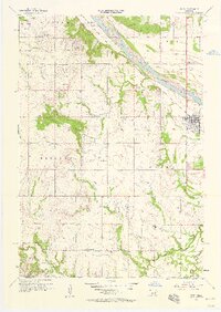 1957 Bixby1958 Print · USGSThe Arkansas River valley comes alive in the mid-1950s as petroleum development reshapes the landscape near the Tulsa and Okmulgee county line. Genealogists and local historians can trace family roots through sites like Shellenbarger Ch, Liberty Sch, and the Bixby Cem.6 unique versions available
 - 1958 Map of Tulsa, 1968 Print
 1958 Tulsa1968 Print · USGSNortheast Oklahoma and the Ozark borderlands are captured here during a massive era of reservoir construction and highway expansion. Researchers can trace the mid-century footprints of Tulsa, the sprawling Lake O' the Cherokees, and historical sites like Pea Ridge National Military Park.3 unique versions available
End of results
Showing maps 1-6 of 6
Top cities near Bixby
- Tulsa historical maps
- Broken Arrow historical maps
- Sapulpa historical maps
- Sand Springs historical maps
- Jenks historical maps
- Glenpool historical maps
See more
Frequently asked questions
- What are the different types of historical maps available for Bixby?
- What is the oldest map of Bixby?
- Where can I purchase historical maps of Bixby for my home or office?
- Where can I download high-res historical maps of Bixby?
- Are there historical topographic maps available for Bixby?
- Is there historical aerial imagery available for Bixby?
- Where are historical maps of Bixby sourced from?