1970s Maps of Bixby, Oklahoma
Explore 4 historic maps of Bixby from the 1970s. These maps offer a rare glimpse into what life looked like during the 1970s — showing old roads, neighborhoods, homes, and landmarks that have changed or disappeared over time.
Whether you're researching your family's past, planning a metal detecting trip, or studying how Bixby's landscape evolved across the 1970s, these high-resolution maps are a powerful tool for exploring the history of this region.
- Focus on a specific era: All maps on this page are from the 1970s, giving you a focused view of this time period.
- See what’s changed: Compare century-old streets, trails, and buildings to today's modern landscape using overlays and satellite layers.
- Research with precision: Use these maps for genealogy, historical research, land use analysis, or educational projects.
- View, download, or print: Maps are fully viewable online in high resolution, and can be downloaded or printed for your own records.
Start exploring Bixby's history through authentic maps from the 1970s. This is your window into the past.
Bixby, OK maps
(4)- 1971 Map of Spanish Peak, 1972 Print
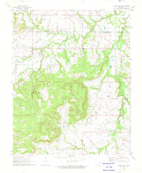 1971 Spanish Peak1972 Print · USGSThe Oklahoma borderlands of Tulsa and Okmulgee counties come alive in the early seventies, showing a landscape shaped by petroleum and ranching. Genealogists and local historians can trace the foundations of Hectorville, locate the Liberty Sch, and find family sites like the Bruner Cem.2 unique versions available
 - 1971 Map of Concharty Mountain, 1973 Print
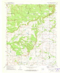 1971 Concharty Mountain1973 Print · USGSOklahoma's rugged coal and oil country comes into sharp focus during the early 1970s at the junction of four counties. Researchers can trace rural life and industry through landmarks like Bald Hill Cem, Twin Hills Sch, and the local Coal Mines.2 unique versions available
 - 1978 Map of Muskogee, 1979 Print
 1978 Muskogee1979 Print · USGSThe confluence of the Arkansas, Verdigris, and Neosho Rivers defines the Muskogee region in the late seventies. Genealogists and historians can trace the footprints of Camp Gruber (Abandoned), the campus of Bacone College, and early aviation at Hatbox Field.
 - 1978 Map of Fort Smith, 1979 Print
 1978 Fort Smith1979 Print · USGSThe Arkansas-Oklahoma borderlands in the late seventies show a landscape shaped by massive river reservoirs and sprawling military reservations. Trace the historic rail lines of the Missouri Pacific RR and locate regional landmarks like Fort Gibson, Tenkiller Ferry Lake, and Barling.2 unique versions available
End of results
Showing maps 1-4 of 4
Top cities near Bixby
- Tulsa historical maps
- Broken Arrow historical maps
- Sapulpa historical maps
- Sand Springs historical maps
- Jenks historical maps
- Glenpool historical maps
See more
Frequently asked questions
- What are the different types of historical maps available for Bixby?
- What is the oldest map of Bixby?
- Where can I purchase historical maps of Bixby for my home or office?
- Where can I download high-res historical maps of Bixby?
- Are there historical topographic maps available for Bixby?
- Is there historical aerial imagery available for Bixby?
- Where are historical maps of Bixby sourced from?