1900s (20th Century) Maps of Washington County, Oklahoma
Explore 33 historic maps of Washington County from the 1900s (20th Century). These maps offer a rare glimpse into what life looked like during the 1900s — showing old roads, neighborhoods, homes, and landmarks that have changed or disappeared over time.
Whether you're researching your family's past, planning a metal detecting trip, or studying how Washington County's landscape evolved across the 1900s, these high-resolution maps are a powerful tool for exploring the history of this region.
- Focus on a specific era: All maps on this page are from the 1900s, giving you a focused view of this time period.
- See what’s changed: Compare century-old streets, trails, and buildings to today's modern landscape using overlays and satellite layers.
- Research with precision: Use these maps for genealogy, historical research, land use analysis, or educational projects.
- View, download, or print: Maps are fully viewable online in high resolution, and can be downloaded or printed for your own records.
Start exploring Washington County's history through authentic maps from the 1900s. This is your window into the past.
Washington County, OK maps
(33)- 1901 Map of Claremore
 1901 Claremore1901 Print · USGSThe Cherokee, Osage, and Creek Nations converge in the Indian Territory during this era of rapid railroad expansion. Researchers can trace early settlements and tribal boundaries, locating the Island Ferry, the junction at Claremore, and early Tulsa.4 unique versions available
 - 1901 Map of Nowata
 1901 Nowata1901 Print · USGSThe Cherokee Nation in Indian Territory is captured here at the start of the twentieth century, showing the lands that would soon become northeast Oklahoma. Researchers can trace early rail-town growth in Nowata and Bartlesville or locate smaller settlements like Alluwe and Coodys Bluff.2 unique versions available
 - 1909 Map of Pawhuska, 1957 Print
 1909 Pawhuska1957 Print · USGSOsage County comes alive in this turn-of-the-century survey of the terrain around Pawhuska and its neighboring rail towns. Trace the paths of three major railroads as they pass through Barnsdall, find landmarks like Daltons Caves, or locate the White Swan Ford.
 - 1910 Map of Pawhuska
 1910 Pawhuska1910 Print · USGSOsage County's landscape at the dawn of Oklahoma statehood reveals a transition from tribal lands to a rail-connected economy. Genealogists and historians can trace early settlements like Wynona and Bigheart, or find local landmarks like Daltons Caves and White Swan Ford.2 unique versions available
 - 1912 Map of Hominy, 1960 Print
 1912 Hominy1960 Print · USGSNortheastern Oklahoma comes alive in this pre-reservoir survey, documenting the river-valley settlements and tribal lands of the early statehood era. Genealogists can locate dozens of country schools and sites like Black Dog (Indian Village) or the early Oil City Barnsdall P O.
 - 1914 Map of Nowata
 1914 Nowata1914 Print · USGSNortheastern Oklahoma at the height of its early statehood growth is documented here as the railroad network expanded across the Verdigris River valley. Genealogists can locate dozens of country schools like Go-back School and vanished post offices such as Avelia Wayside PO.5 unique versions available
 - 1914 Map of Claremore, 1959 Print
 1914 Claremore1959 Print · USGSNortheastern Oklahoma was a landscape of river crossings and rail towns in the years just before the Great War. Genealogists and researchers can trace the locations of dozens of vanished rural schools like Elm Ridge School, river landmarks such as Thomas Ferry, and the early footprints of Broken Arrow and Tulsa.
 - 1915 Map of Hominy
 1915 Hominy1915 Print · USGSOsage and Creek counties come to life in the years before the Great War, showing a landscape defined by river confluences and the expansion of the rail industry. Genealogists can locate early settlements like Black Dog and schools like Dripping Spring School or Sunset School.2 unique versions available
 - 1916 Map of Claremore
 1916 Claremore1916 Print · USGSThe Verdigris River valley and the burgeoning rail hubs of Rogers and Tulsa counties are captured here just after Oklahoma statehood. Genealogists can locate family homesteads near dozens of early schools like Fair Valley School or early churches such as Greenwood Chapel.4 unique versions available
 - 1954 Map of Tulsa
 1954 Tulsa1954 Print · USGSNortheast Oklahoma and the Ozark border are shown here during a period of massive industrial and infrastructure growth. Researchers can trace the legacy of the Tri-State Mining District and the development of major reservoirs like Grand Lake O' The Cherokees.2 unique versions available
 - 1955 Map of Enid, 1966 Print
 1955 Enid1966 Print · USGSNorth-central Oklahoma's transition from open plains to the blackjack hills of the Osage Indian Reservation is captured in the mid-1950s. Researchers can trace the development of the Naval Reserve Oil Field, the grounds of Vance AFB, and the early footprints of Tulsa and Stillwater.4 unique versions available
 - 1958 Map of Enid
 1958 Enid1958 Print · USGSNorthern Oklahoma is mapped here in the late fifties, showcasing a dense network of petroleum production and historic tribal lands. Researchers can trace the legacy of the Osage Indian Reservation, early energy hubs like the Cushing Oil Field, and the Chilocco Indian Agricultural School.2 unique versions available
 - 1958 Map of Tulsa, 1968 Print
 1958 Tulsa1968 Print · USGSNortheast Oklahoma and the Ozark borderlands are captured here during a massive era of reservoir construction and highway expansion. Researchers can trace the mid-century footprints of Tulsa, the sprawling Lake O' the Cherokees, and historical sites like Pea Ridge National Military Park.3 unique versions available
 - 1959 Map of Collinsville NE, 1961 Print
 1959 Collinsville NE1961 Print · USGSNortheastern Oklahoma at the end of the fifties is a landscape of river bends and industrial growth. Researchers can trace the Caney River floodplain or locate rural landmarks like Zion Hill Ch and the strip mine operations.3 unique versions available
 - 1959 Map of Vera, 1961 Print
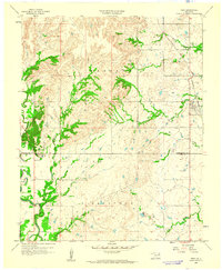 1959 Vera1961 Print · USGSThe northern Oklahoma landscape at the end of the fifties reveals a rural frontier defined by the rail line through Vera. Genealogists and historians can trace family-named landmarks like Hillside Ch and early petroleum sites including numerous Oil Wells near Bird Creek.2 unique versions available
 - 1963 Map of Tulsa
 1963 Tulsa1963 Print · USGSThe Oklahoma and Arkansas borderlands are shown here in the early sixties, a time of massive reservoir construction and heavy mining. Genealogists can trace family roots through settlements like Nowata, Pryor, and Jay, or locate historical zinc and lead mines and coal mines.
 - 1966 Map of Avant, 1967 Print
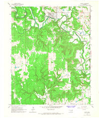 1966 Avant1967 Print · USGSOsage County is captured in the mid-1960s as a landscape of river-valley settlements and active industrial fields. Researchers can trace the Midland Valley rail route through Avant and locate family sites at Avant Cem or Lombard Cem.4 unique versions available
 - 1970 Map of Bartlesville SE, 1972 Print
 1970 Bartlesville SE1972 Print · USGSThe tri-county borderlands of northeastern Oklahoma are captured here in the early 1970s, showcasing a landscape of winding river bends and prairie creeks. Researchers can locate infrastructure of the local economy, including the Tyner Dam, a riverside Oil Well, and the Gravel Pit.2 unique versions available
 - 1971 Map of Bowring, 1973 Print
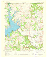 1971 Bowring1973 Print · USGSOsage County's landscape in the early seventies centers on the newly established Hulah Lake and the shifting economy of northern Oklahoma. Genealogists and local historians can trace family-named sites and infrastructure near Bowring, the Old Railroad Grade, and Deadmans Rock.
 - 1971 Map of Bartlesville South, 1973 Print
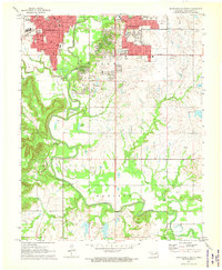 1971 Bartlesville South1973 Print · USGSBartlesville was a thriving education and energy hub in the early seventies, caught here as residential life expanded south toward the river. Genealogists and historians can trace institutional sites like Wesleyan College and Memorial Park Cemetery or follow the rails of the Missouri Kansas and Texas.3 unique versions available
 - 1971 Map of Woolaroc, 1973 Print
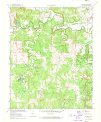 1971 Woolaroc1973 Print · USGSOsage County in the early seventies shows a landscape where high-culture estates and heavy industry meet. Genealogists and historians can locate the Woolaroc Museum, trace the Missouri-Kansas-Texas rail line, and find local landmarks like Osage Hills Sch.2 unique versions available
 - 1971 Map of Bartlesville North, 1973 Print
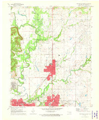 1971 Bartlesville North1973 Print · USGSNorthern Oklahoma's petroleum and rail corridors are captured in the early seventies, centered on the growing towns of Dewey and Bartlesville. Researchers can trace the extensive Jefferson Oil Field operations or locate local landmarks like the Antioch Ch and Johnstone Park.2 unique versions available
 - 1971 Map of Bowring SE, 1973 Print
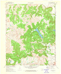 1971 Bowring SE1973 Print · USGSOsage and Washington counties in the early 1970s showcase a transition between petroleum production and growing recreational development. Genealogists and historians can trace the industrial footprint of Caney Field and local social life at the Sunset Country Club.
 - 1972 Map of Wolco, 1973 Print
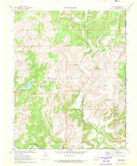 1972 Wolco1973 Print · USGSOsage County in the early seventies is mapped here as an active petroleum landscape centered on Wolco. Genealogists and historians can trace old property lines and industrial sites, from the banks of Lake Waxhoma to family plots at the Cem near Candy Creek.
 - 1972 Map of Blue Mound, 1974 Print
 1972 Blue Mound1974 Print · USGSThe northern Oklahoma countryside near the Nowata county line is shown in the early 1970s as an active corridor of extraction and transport. Researchers can trace the extensive Oil Fields and follow the path of the Missouri - Kansas - Texas railroad past landmarks like Blue Mound.2 unique versions available
Showing maps 1-25 of 33
Top cities of Washington County
- Bartlesville historical maps
- Dewey historical maps
- Copan historical maps
- Ramona historical maps
- Ochelata historical maps
- Vera historical maps
Frequently asked questions
- What are the different types of historical maps available for Washington County?
- What is the oldest map of Washington County?
- Where can I purchase historical maps of Washington County for my home or office?
- Where can I download high-res historical maps of Washington County?
- Are there historical topographic maps available for Washington County?
- Is there historical aerial imagery available for Washington County?
- Where are historical maps of Washington County sourced from?