1980s Maps of New Cordell, Oklahoma
Explore 4 historic maps of New Cordell from the 1980s. These maps offer a rare glimpse into what life looked like during the 1980s — showing old roads, neighborhoods, homes, and landmarks that have changed or disappeared over time.
Whether you're researching your family's past, planning a metal detecting trip, or studying how New Cordell's landscape evolved across the 1980s, these high-resolution maps are a powerful tool for exploring the history of this region.
- Focus on a specific era: All maps on this page are from the 1980s, giving you a focused view of this time period.
- See what’s changed: Compare century-old streets, trails, and buildings to today's modern landscape using overlays and satellite layers.
- Research with precision: Use these maps for genealogy, historical research, land use analysis, or educational projects.
- View, download, or print: Maps are fully viewable online in high resolution, and can be downloaded or printed for your own records.
Start exploring New Cordell's history through authentic maps from the 1980s. This is your window into the past.
New Cordell, OK maps
(4)- 1983 Map of Dill City SE, 1984 Print
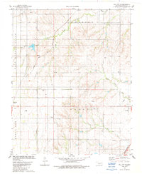 1983 Dill City SE1984 Print · USGSWashita County's agricultural and energy landscape is shown here in the early 1980s as rail transport and creek systems shaped local growth. Family historians can trace local roots through Old Boggy Cem and Sod Cem, or locate the junction at Burns Flat Junction.
 - 1983 Map of Cordell, 1984 Print
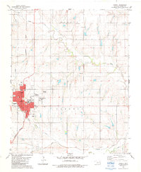 1983 Cordell1984 Print · USGSCordell and its surrounding prairies are captured in the early 1980s, showcasing a rural Oklahoma community centered on its schools and rail lines. Researchers can trace local heritage through the Lincoln School, Lawnview Cemetery, and the Burlington Northern railroad.
 - 1985 Map of Elk City
 1985 Elk City1985 Print · USGSWestern Oklahoma in the 1980s is defined by its railroad junctions, emerging aviation hubs, and the winding North Fork Red River. Genealogists and local historians can trace the foundations of Sayre and Elk City, alongside landmarks like Clinton-Sherman Airport and Quartz Mountain State Park.2 unique versions available
 - 1986 Map of Anadarko
 1986 Anadarko1986 Print · USGSThe Oklahoma plains around Anadarko are captured in the mid-1980s, showing the intersection of rail history and tribal heritage. Genealogists and historians can trace the Indian Treaty Boundary or locate old rail stops along the Burlington Northern Railroad and Atchison, Topeka and Santa Fe Railway.2 unique versions available
End of results
Showing maps 1-4 of 4
Top cities near New Cordell
- Clinton historical maps
- Burns Flat historical maps
- Sentinel historical maps
- Mountain View historical maps
- Corn historical maps
- Dill City historical maps
See more
Frequently asked questions
- What are the different types of historical maps available for New Cordell?
- What is the oldest map of New Cordell?
- Where can I purchase historical maps of New Cordell for my home or office?
- Where can I download high-res historical maps of New Cordell?
- Are there historical topographic maps available for New Cordell?
- Is there historical aerial imagery available for New Cordell?
- Where are historical maps of New Cordell sourced from?