Old Maps of Baker City, Oregon for Academic Research
Study the evolution of Baker City with 11 high-resolution historic maps. Whether you're teaching, researching, or modeling changes in land use, these maps provide essential visual documentation of urban, environmental, and geographic change.
- Analyze long-term change: Track patterns in development, transportation, and natural features.
- Ideal for environmental or urban studies: Support academic projects with primary historical map data.
- Use in the classroom or lab: Educators and researchers rely on these maps to bring historical context to life.
These maps are a powerful tool for teaching, research, and visualizing how Baker City has changed over the decades.
Baker City, OR maps
(11)- 1901 Map of Baker City
 1901 Baker City1901 Print · USGSBaker County at the close of the century was a landscape of bustling rail hubs and active mining districts. Genealogists and historians can trace early settlements like Auburn, follow the Sumpter Valley Railroad line, or locate specific operations like the Flagstaff Mine.4 unique versions available
 - 1955 Map of Baker, 1964 Print
 1955 Baker1964 Print · USGSThe Oregon-Idaho borderlands are captured here in the mid-fifties as the Snake River underwent massive changes from dam construction. Trace the Oregon Trail Memorial Monument near Baker, find early mines like Virtue Mine, and follow the Union Pacific Railroad through Huntington.4 unique versions available
 - 1959 Map of Baker
 1959 Baker1959 Print · USGSThe Oregon and Idaho borderlands come alive in the late fifties, showing the rugged corridor along the Snake River and the high peaks of the Wallowa Mountains. Researchers can trace the legacy of the Union Pacific railroad or locate historic mining sites like the Flagstaff Mine and Virtue Mine.2 unique versions available
 - 1967 Map of Baker, 1971 Print
 1967 Baker1971 Print · USGSBaker emerges as a bustling hub in the late sixties, balancing its pioneer heritage with modern aviation and education. Genealogists can locate family landmarks like Mt Hope Cemetery, Pocahontas, and several neighborhood schools including Brooklyn Sch.2 unique versions available
 - 1981 Map of Baker
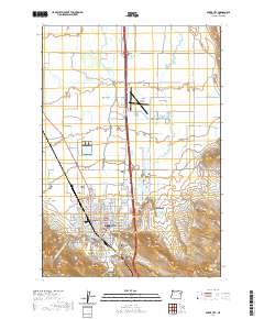
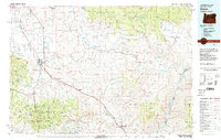 1981 Baker1981 Print · USGSEastern Oregon in the early eighties shows a landscape of deep canyons and high mountain mining districts. Genealogists and researchers can trace the Union Pacific corridor through Baker or locate remote operations like the Young American Mine and Rachel Mine.2 unique versions available
 - 1994 Map of Baker City
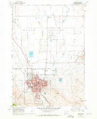
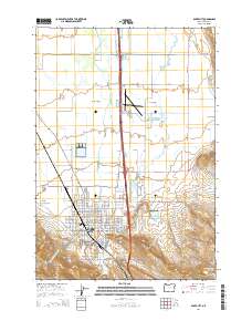
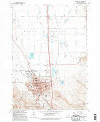 1994 Baker City1994 Print · USGSBaker City and the surrounding Baker Valley are captured in the mid-1990s, revealing a landscape where civic life and irrigation networks meet. Researchers can trace local landmarks like Mt Hope Cemetery, Brooklyn Sch, and the Baker City Municipal Airport.
 - 2011 Map of Baker City, 2011 Print
 2011 Baker City2011 Print · USGSCovers Baker City, including Baker County, United States, and other nearby areas
 - 2014 Map of Baker City, 2014 Print
 2014 Baker City2014 Print · USGSCovers Baker City, including Baker County, United States, and other nearby areas
 - 2017 Map of Baker City, 2017 Print
 2017 Baker City2017 Print · USGSCovers Baker City, including Baker County, United States, and other nearby areas
 - 2020 Map of Baker City, 2020 Print
 2020 Baker City2020 Print · USGSCovers Baker City, including Baker County, United States, and other nearby areas
 - 2024 Map of Baker City, 2024 Print
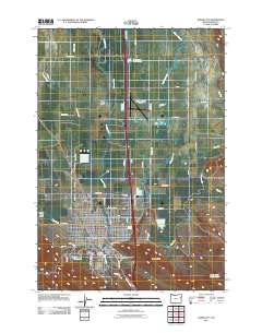
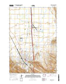
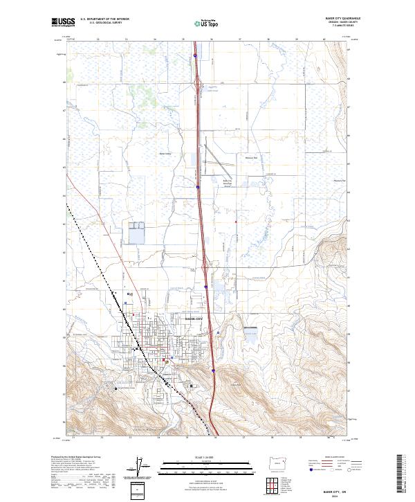 2024 Baker City2024 Print · USGSBaker City and the surrounding valley are captured in this modern survey during a period of sustained high-desert growth. Family history researchers can locate the Sturgill Children Graves and Hope Cem while tracing the path of the Baker Municipal Aqueduct.
End of results
Showing maps 1-11 of 11
Top cities near Baker City
Frequently asked questions
- What are the different types of historical maps available for Baker City?
- What is the oldest map of Baker City?
- Where can I purchase historical maps of Baker City for my home or office?
- Where can I download high-res historical maps of Baker City?
- Are there historical topographic maps available for Baker City?
- Is there historical aerial imagery available for Baker City?
- Where are historical maps of Baker City sourced from?