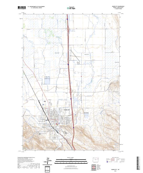
2024 Map of Baker City
USGS Topo · Published 2024About this map
Baker City serves as the focal point of this Eastern Oregon landscape, where the urban grid meets the agricultural expanse of Baker Valley. The town is anchored by civic and historical landmarks, including the Baker County Courthouse and the local Hope Cem. To the south, the terrain rises sharply into the Elkhorn Mountains, providing the elevation for the Baker Municipal Aqueduct and Kolb Reservoir. A complex irrigation network of ditches and sloughs, such as Corral Ditch and Baldock Slough, crisscrosses the flats to the east of the Powder River, supporting the rural area known as Missouri Flat. Genealogists may find particular interest in the Sturgill Children Graves, a poignant marker of early family history located near the municipal boundaries.
Find a feature on this map
121 named features on this map. Tap any name to fly to it.
Don’t see what you’re looking for? This feature index may not catch every label — zoom into the map to look around manually.
Map Details
Editions of this 2024 Baker City Map
This is the sole edition of this map. No revisions or reprints were ever made.
Other maps of this area

1901 · Baker City
USGS Topo · 1:125,000

1955 · Baker
USGS Topo · 1:250,000

1959 · Baker
USGS Topo · 1:250,000

1967 · Virtue Flat
USGS Topo · 1:24,000

1967 · Encina
USGS Topo · 1:24,000

1967 · Baker
USGS Topo · 1:24,000
1967 · Keating NW
USGS Topo · 1:24,000
1967 · Haines
USGS Topo · 1:24,000
1967 · Magpie Peak
USGS Topo · 1:24,000

1967 · Blue Canyon
USGS Topo · 1:24,000