Old Maps of Lime, Oregon for Academic Research
Study the evolution of Lime with 9 high-resolution historic maps. Whether you're teaching, researching, or modeling changes in land use, these maps provide essential visual documentation of urban, environmental, and geographic change.
- Analyze long-term change: Track patterns in development, transportation, and natural features.
- Ideal for environmental or urban studies: Support academic projects with primary historical map data.
- Use in the classroom or lab: Educators and researchers rely on these maps to bring historical context to life.
These maps are a powerful tool for teaching, research, and visualizing how Lime has changed over the decades.
Lime, OR maps
(9)- 1951 Map of Huntington, 1953 Print
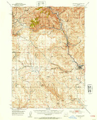 1951 Huntington1953 Print · USGSEastern Oregon in the early fifties shows a landscape shaped by the Union Pacific and the historic Oregon Trail. Researchers can trace the river-and-rail economy through the Placer Mines of Dixie Creek and the industrial works at Lime.3 unique versions available
 - 1955 Map of Baker, 1964 Print
 1955 Baker1964 Print · USGSThe Oregon-Idaho borderlands are captured here in the mid-fifties as the Snake River underwent massive changes from dam construction. Trace the Oregon Trail Memorial Monument near Baker, find early mines like Virtue Mine, and follow the Union Pacific Railroad through Huntington.4 unique versions available
 - 1959 Map of Baker
 1959 Baker1959 Print · USGSThe Oregon and Idaho borderlands come alive in the late fifties, showing the rugged corridor along the Snake River and the high peaks of the Wallowa Mountains. Researchers can trace the legacy of the Union Pacific railroad or locate historic mining sites like the Flagstaff Mine and Virtue Mine.2 unique versions available
 - 1980 Map of Brogan, 1997 Print
 1980 Brogan1997 Print · USGSThe Oregon-Idaho borderlands come alive in this late-century survey of the high desert and river valleys. Researchers can trace the legacy of ranching and transport through sites like Malheur City, the Union Pacific rail lines, and the Snake River crossings.
 - 1988 Map of Lime
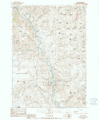 1988 Lime1988 Print · USGSThe Burnt River canyon in the late eighties serves as a rugged industrial corridor for mining and transit. Researchers can trace the path of the Oregon Trail alongside the limestone operations at Lime and the historic settlement of Weatherby.
 - 2011 Map of Lime, 2011 Print
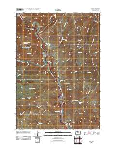 2011 Lime2011 Print · USGSCovers Lime, including Weatherby, Baker County, and other nearby areas
 - 2014 Map of Lime, 2014 Print
 2014 Lime2014 Print · USGSCovers Lime, including Weatherby, Baker County, and other nearby areas
 - 2020 Map of Lime, 2020 Print
 2020 Lime2020 Print · USGSCovers Lime, including Weatherby, Baker County, and other nearby areas
 - 2023 Map of Lime, 2023 Print
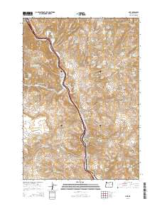
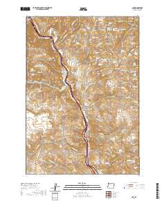
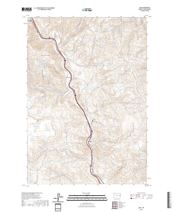 2023 Lime2023 Print · USGSEastern Oregon's Burnt River corridor remains a landscape of high ridges and narrow valleys at the start of the 2020s. Researchers can locate the Dixie Cem and trace the paths of Rye Valley Ln and Oregon Trail Blvd near Lime.
End of results
Showing maps 1-9 of 9
Top cities near Lime
Frequently asked questions
- What are the different types of historical maps available for Lime?
- What is the oldest map of Lime?
- Where can I purchase historical maps of Lime for my home or office?
- Where can I download high-res historical maps of Lime?
- Are there historical topographic maps available for Lime?
- Is there historical aerial imagery available for Lime?
- Where are historical maps of Lime sourced from?