Old Maps of Alpine, Oregon for Hiking & Exploration
Hike through history with 17 historic maps of Alpine. Explore old trails, ghost towns, and forgotten backroads — perfect for outdoor adventurers and local explorers.
- Rediscover forgotten places: Map out old mining camps, roads, and footpaths that no longer exist on modern maps.
- Layer with modern tools: Combine with LiDAR or satellite views to plan hikes through historical terrain.
- Made for exploration: Popular among hikers, overlanders, and local history lovers.
Use these maps to find adventure and explore the hidden past of Alpine.
Alpine, OR maps
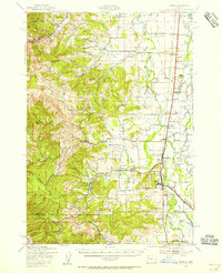
(17)- 1911 Map of Monroe
 1911 Monroe1911 Print · USGSThe Willamette Valley foothills meet the river bottomlands in the early twentieth century near the Benton and Lane county border. Genealogists and researchers can trace early settlements at Bellfountain and Alpine or locate rural landmarks like Irish Bend School and Ferguson Bridge.
 - 1922 Map of Monroe
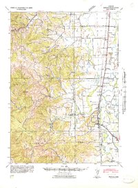
 1922 Monroe1922 Print · USGSThe Willamette Valley’s southern reaches come to life in this survey from the decade after the Great War, showing the early infrastructure of Benton and Lane counties. Genealogists can trace family footprints across dozens of country schools like Winkle School and lost rail stops along the Southern Pacific line.4 unique versions available
 - 1939 Map of Monroe, 1956 Print
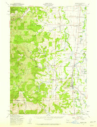
 1939 Monroe1956 Print · USGSBenton County agriculture and timber meet at the foot of the Coast Range in the late thirties. Genealogists can trace family footprints through the numerous rural school districts, including Beaver Creek Sch, or locate old rail stops at Alpine Junction and Burnett.
 - 1942 Map of Monroe
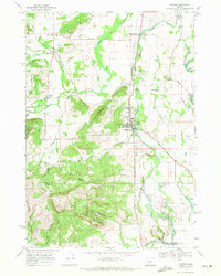
 1942 Monroe1942 Print · USGSBenton and Lane counties are shown just as the nation entered the war, featuring the river-and-rail corridor of the Long Tom River. Researchers can trace the rural landscape of schoolhouses and cemeteries like Oak Ridge Sch and Oak Ridge Cem.
 - 1953 Map of Salem
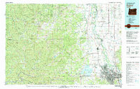
 1953 Salem1953 Print · USGSMid-century Oregon comes to life through this detailed survey of the Willamette Valley and the adjacent Pacific coastline. Researchers can trace the rail lines of the Southern Pacific RR, visit rural hubs like Fairview School, or locate coastal landmarks like the Yaquina Head Lighthouse.
 - 1954 Map of Salem
 1954 Salem1954 Print · USGSMid-century Western Oregon is centered on the productive Willamette River valley as its cities and infrastructure expand toward the mountains. Genealogists and historians can trace the rail lines of the Southern Pacific RR and Oregon Electric Ry through towns like Dallas, Independence, and Brownsville.
 - 1957 Map of Monroe, 1959 Print
 1957 Monroe1959 Print · USGSBenton and Lane counties come alive in the late fifties, showcasing a landscape of riverside farms and timbered peaks. Genealogists and historians can locate Oak Ridge Cemetery, trace the Southern Pacific line, or find old school sites like Inavale School.2 unique versions available
 - 1960 Map of Salem, 1968 Print
 1960 Salem1968 Print · USGSThe Willamette Valley and the surrounding mountain ranges are shown here in the 1960s during a period of significant reservoir construction. Genealogists and historians can trace rail lines like the Oregon Electric and find communities from Lincoln City on the coast to Sweet Home and Mill City in the foothills.2 unique versions available
 - 1962 Map of Salem
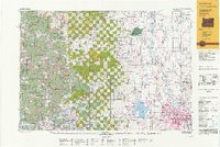
 1962 Salem1962 Print · USGSThe Willamette Valley and the surrounding Oregon ranges are captured here in the early sixties, showing the vital growth of the state's primary agricultural and academic corridor. Researchers can trace the mid-century footprints of Oregon State University and the University of Oregon, alongside rural landmarks like Camp Adair and Black Butte Mine.
 - 1963 Map of Salem
 1963 Salem1963 Print · USGSMid-century Oregon comes into focus as the Willamette Valley’s timber and agricultural industries meet the growing campuses of Oregon State University and the University of Oregon. Researchers can trace old rail lines like the Oregon Electric Railway and locate family plots at Siletz Cem or Dallas Cem.
 - 1969 Map of Monroe, 1971 Print
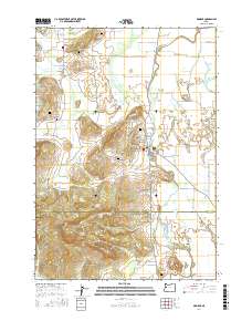
 1969 Monroe1971 Print · USGSBenton and Lane counties are surveyed here in the late sixties, capturing the agricultural and timber corridor of the Willamette Valley. Genealogists can trace family names and sites such as Bellfountain Cem, Irish Bend Sch, and the settlement at Alpine.2 unique versions available
 - 1980 Map of Eugene
 1980 Eugene1980 Print · USGSThe southern Willamette Valley and Coast Range are captured in the early eighties as the urban centers of Eugene and Springfield expanded. Researchers can trace the legacy of family estates and regional infrastructure through landmarks like Mahlon Sweet Airport, Fern Ridge Lake, and Junction City.
 - 1992 Map of Eugene
 1992 Eugene1992 Print · USGSThe Willamette Valley and Coast Range are captured in the early nineties, showing the growth of Eugene and Springfield. Researchers can trace timber history in the Siuslaw National Forest or locate valley settlements like Junction City and Harrisburg.
 - 2011 Map of Monroe, 2011 Print
 2011 Monroe2011 Print · USGSCovers Alpine, including Monroe, Bellfountain, and other nearby areas
 - 2014 Map of Monroe, 2014 Print
 2014 Monroe2014 Print · USGSCovers Alpine, including Monroe, Bellfountain, and other nearby areas
 - 2017 Map of Monroe, 2017 Print
 2017 Monroe2017 Print · USGSCovers Alpine, including Monroe, Bellfountain, and other nearby areas
 - 2023 Map of Monroe, 2023 Print
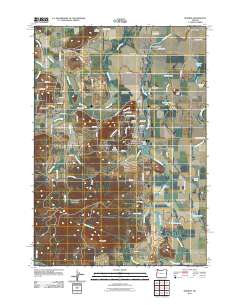
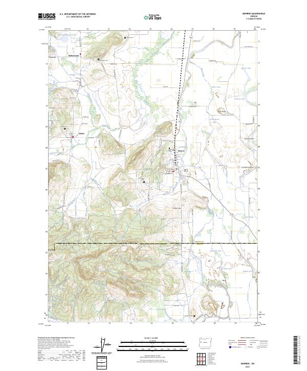 2023 Monroe2023 Print · USGSThe area around Monroe and Bellfountain is shown here in its modern agricultural and timber context. Researchers can trace family history through sites like Saint Rose Cem, Alpine Cem, and the family-named Ingram Island.
End of results
Showing maps 1-17 of 17
Top cities near Alpine
- Eugene historical maps
- Corvallis historical maps
- Junction City historical maps
- Philomath historical maps
- Harrisburg historical maps
- Monroe historical maps
Frequently asked questions
- What are the different types of historical maps available for Alpine?
- What is the oldest map of Alpine?
- Where can I purchase historical maps of Alpine for my home or office?
- Where can I download high-res historical maps of Alpine?
- Are there historical topographic maps available for Alpine?
- Is there historical aerial imagery available for Alpine?
- Where are historical maps of Alpine sourced from?