1990s Maps of Columbia County, Oregon
Explore 9 historic maps of Columbia County from the 1990s. These maps offer a rare glimpse into what life looked like during the 1990s — showing old roads, neighborhoods, homes, and landmarks that have changed or disappeared over time.
Whether you're researching your family's past, planning a metal detecting trip, or studying how Columbia County's landscape evolved across the 1990s, these high-resolution maps are a powerful tool for exploring the history of this region.
- Focus on a specific era: All maps on this page are from the 1990s, giving you a focused view of this time period.
- See what’s changed: Compare century-old streets, trails, and buildings to today's modern landscape using overlays and satellite layers.
- Research with precision: Use these maps for genealogy, historical research, land use analysis, or educational projects.
- View, download, or print: Maps are fully viewable online in high resolution, and can be downloaded or printed for your own records.
Start exploring Columbia County's history through authentic maps from the 1990s. This is your window into the past.
Columbia County, OR maps
(9)- 1990 Map of Sauvie Island, 1995 Print
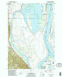 1990 Sauvie Island1995 Print · USGSSauvie Island and the Columbia River confluence appear here in the early 1990s, where river hydrology meets the Tualatin foothills. Trace the historical tracks of the Burlington Northern RR through Burlington and Holbrook, or explore the old river landings at Chapman Landing and Morgan Landing.
 - 1990 Map of Dixie Mountain, 1995 Print
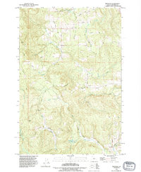
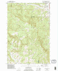 1990 Dixie Mountain1995 Print · USGSThe northern Tualatin Mountains near the turn of the millennium were a landscape of steep timbered ridges and pioneer-era roads. Researchers can find old family sites and burial grounds like Saint Wenceslaus Cemetery, Fairview Cem, and landmarks along Skyline Boulevard.
 - 1990 Map of Deer Island, 1995 Print
 1990 Deer Island1995 Print · USGSThe Columbia River islands and Washington-Oregon borderlands are captured here in the 1990s. Genealogists and local historians can trace family-named sites like Maple Hill and McBride Creek or locate the old Cem near Woodland.
 - 1990 Map of Saint Helens, 1995 Print
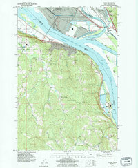
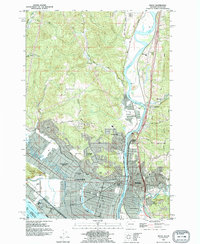
 1990 Saint Helens1995 Print · USGSThe Columbia River corridor near the Oregon-Washington border is captured here during the mid-nineties, showing the evolving relationship between industry and wildlife preservation. Researchers can trace the Portland & Western RR through Warren or locate local landmarks like Warrior Rock and the Scappoose Industrial Airpark.
 - 1990 Map of Trenholm, 1995 Print
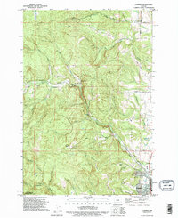
 1990 Trenholm1995 Print · USGSColumbia County’s timbered ridges and creek valleys are documented here in the early 1990s. Researchers can trace rural developments at Beaver Homes and Trenholm, or locate specific family-named landmarks like Whitney Basin and Serafin Point.
 - 1990 Map of Chapman, 1995 Print
 1990 Chapman1995 Print · USGSScappoose and the surrounding Columbia County hills are shown here in the 1990s, where small settlements met an active landscape of timber and stone. Genealogists and local historians can trace family-named roads and sites like Yankton, the Substation Church, and Bonnie Falls.
 - 1990 Map of Rainier, 1995 Print
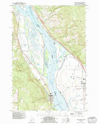
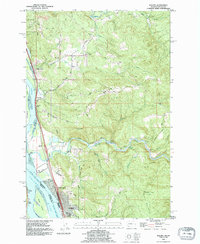
 1990 Rainier1995 Print · USGSAlong the Columbia River in the early nineties, industrial waterfronts met the rural hills of Oregon. Trace family roots at Hudson Cem, explore the riverside at Rainier, or locate the Power Plant at Trojan.
 - 1990 Map of Kalama, 1995 Print
 1990 Kalama1995 Print · USGSSettled along the busy river-and-rail corridor of the lower Columbia, this area in the early nineties shows a landscape balanced between industry and timbered uplands. Researchers can trace family sites at Rose Valley Cemetery, explore the riverside rail lines of the Burlington Northern, and locate old landmarks like the Salmon Hatchery and Carrolls Bluff.
 - 1990 Map of Kelso, 1995 Print
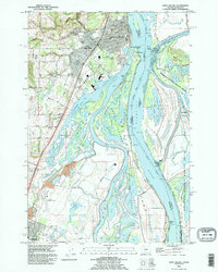
 1990 Kelso1995 Print · USGSThe industrial and riverfront centers of the Pacific Northwest are captured in the 1990s as the cities grew around the Cowlitz River. Genealogists and historians can trace neighborhood development near Lower Columbia College and locate old settlements like Ostrander and Pleasant Hill.
End of results
Showing maps 1-9 of 9
Top cities of Columbia County
- Saint Helens historical maps
- Scappoose historical maps
- Vernonia historical maps
- Columbia City historical maps
- Rainier historical maps
- Clatskanie historical maps
See more
Frequently asked questions
- What are the different types of historical maps available for Columbia County?
- What is the oldest map of Columbia County?
- Where can I purchase historical maps of Columbia County for my home or office?
- Where can I download high-res historical maps of Columbia County?
- Are there historical topographic maps available for Columbia County?
- Is there historical aerial imagery available for Columbia County?
- Where are historical maps of Columbia County sourced from?