1900s (20th Century) Maps of Toketee Village, Oregon
Explore 7 historic maps of Toketee Village from the 1900s (20th Century). These maps offer a rare glimpse into what life looked like during the 1900s — showing old roads, neighborhoods, homes, and landmarks that have changed or disappeared over time.
Whether you're researching your family's past, planning a metal detecting trip, or studying how Toketee Village's landscape evolved across the 1900s, these high-resolution maps are a powerful tool for exploring the history of this region.
- Focus on a specific era: All maps on this page are from the 1900s, giving you a focused view of this time period.
- See what’s changed: Compare century-old streets, trails, and buildings to today's modern landscape using overlays and satellite layers.
- Research with precision: Use these maps for genealogy, historical research, land use analysis, or educational projects.
- View, download, or print: Maps are fully viewable online in high resolution, and can be downloaded or printed for your own records.
Start exploring Toketee Village's history through authentic maps from the 1900s. This is your window into the past.
Toketee Village, OR maps
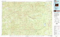
(7)- 1917 Map of Diamond Lake
 1917 Diamond Lake1917 Print · USGSThe high Cascades of Douglas and Klamath Counties are captured here just before the First World War. Local historians and hikers can trace early forest service outposts like Higdon Ranger Sta and remote routes including the Ft Klamath Road and Bradley Trail.3 unique versions available
 - 1956 Map of Toketee Falls
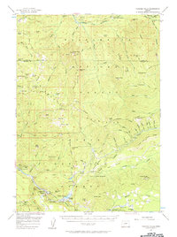 1956 Toketee Falls1956 Print · USGSThe Oregon Cascades high country is shown here in the mid-fifties, just as hydroelectric development was transforming the river canyons. You can trace the complex water systems near Toketee Falls and find remote fire lookouts like Balm Lookout and Cinder Prairie Lookout.2 unique versions available
 - 1958 Map of Roseburg, 1960 Print
 1958 Roseburg1960 Print · USGSThe timber valleys and high volcanic peaks of Southern Oregon are captured here in the late fifties. Researchers can trace the Southern Pacific rail line through historic settlements like Cottage Grove, Yoncalla, and Oakridge near the Cascade Range crest.4 unique versions available
 - 1959 Map of Roseburg
 1959 Roseburg1959 Print · USGSThe Umpqua and Willamette valleys meet the high Cascades in this late-fifties study of Southern Oregon's timber and rail corridors. Genealogists and researchers can trace the Southern Pacific RR through historic towns like Roseburg, Yoncalla, and Cottage Grove.
 - 1978 Map of Diamond Lake, 1994 Print
 1978 Diamond Lake1994 Print · USGSThe Cascades of the late 1970s are seen here at a point of high-mountain industry and recreation across the Umpqua and Willamette forests. Researchers can trace the development of timber and water resources around Toketee Falls, Umpqua Mine, and Steamboat.2 unique versions available
 - 1986 Map of Toketee Falls
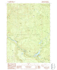 1986 Toketee Falls1986 Print · USGSThe North Umpqua River’s hydroelectric network is fully realized in the 1980s, showcasing a landscape of reservoirs and powerhouses. Researchers can trace the industrial corridor from Toketee Falls to the Soda Springs Dam and locate landmarks like the Indian Caves.
 - 1997 Map of Toketee Falls, 2000 Print
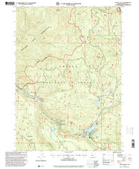 1997 Toketee Falls2000 Print · USGSThe Umpqua National Forest in the late nineties shows a sophisticated hydroelectric network along the North Umpqua River. Trace the paths of the Slide Creek Aqueduct and Lemolo Two Canal between the Slide Creek Powerplant and Toketee Falls.
End of results
Showing maps 1-7 of 7
Frequently asked questions
- What are the different types of historical maps available for Toketee Village?
- What is the oldest map of Toketee Village?
- Where can I purchase historical maps of Toketee Village for my home or office?
- Where can I download high-res historical maps of Toketee Village?
- Are there historical topographic maps available for Toketee Village?
- Is there historical aerial imagery available for Toketee Village?
- Where are historical maps of Toketee Village sourced from?