
1978 Map of Diamond Lake
USGS Topo · Published 1994About this map
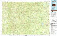
The Calapooya Mountains and the headwaters of the North Umpqua River dominate this 1970s landscape, illustrating a region defined by high-altitude hydrology and federal land management. Large reservoirs like Lemolo Lake and Toketee Reservoir are central to the terrain, supporting the descent toward Toketee Falls. The map reveals the intricate network of the Umpqua National Forest and adjacent timberlands, where small outposts like Steamboat and Mowich serve as solitary markers of human activity. To the south, the Pumice Desert near Crater Lake National Park offers a stark contrast to the dense drainage basins of Copeland Creek and Boulder Creek. This survey provides a record of the Cascades before modern infrastructure further altered these watersheds, highlighting remote industrial sites such as the Umpqua Mine and specialized transit points like the Toketee Landing Strip.
Find a feature on this map
77 named features on this map. Tap any name to fly to it.
Don’t see what you’re looking for? This feature index may not catch every label — zoom into the map to look around manually.
Map Details
Editions of this 1978 Diamond Lake Map
2 editions found
Other maps of this area

1889 · Klamath
USGS Topo · 1:250,000

1891 · Ashland
USGS Topo · 1:250,000

1893 · Ashland
USGS Topo · 1:250,000

1894 · Klamath
USGS Topo · 1:250,000

1897 · Roseburg
USGS Topo · 1:125,000

1897 · Ashland
USGS Topo · 1:250,000

1900 · Roseburg
USGS Topo · 1:125,000

1904 · Riddle
USGS Topo · 1:125,000

1917 · Diamond Lake
USGS Topo · 1:125,000

1925 · Waldo Lake
USGS Topo · 1:125,000