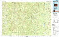
1978 Map of Diamond Lake
USGS Topo · Published 1994About this map
The North Umpqua River and its major tributaries, including Steamboat Creek and the Clearwater River, carve through the complex topography of the Calapooya Mountains. This 1978 revision, compiled from mid-century surveys, shows a landscape defined by massive public land holdings, where the Willamette National Forest, Umpqua National Forest, and Rogue River National Forest converge. The high-elevation eastern terrain is dominated by volcanic features like Mt Thielsen and Mt Bailey, alongside the expansive Pumice Desert. Significant water bodies such as Diamond Lake, Crescent Lake, and Summit Lake serve as primary landmarks in this wilderness-heavy region. The infrastructure is sparse, noted by the presence of the Toketee Landing Strip and remote ridges such as Ragged Ridge and Reynolds Ridge, reflecting a period focused on forest management and backcountry recreation.
Find a feature on this map
33 named features on this map. Tap any name to fly to it.
Don’t see what you’re looking for? This feature index may not catch every label — zoom into the map to look around manually.
Map Details
Editions of this 1978 Diamond Lake Map
2 editions found

Other maps of this area

1889 · Klamath
USGS Topo · 1:250,000

1891 · Ashland
USGS Topo · 1:250,000

1893 · Ashland
USGS Topo · 1:250,000

1894 · Klamath
USGS Topo · 1:250,000

1897 · Roseburg
USGS Topo · 1:125,000

1897 · Ashland
USGS Topo · 1:250,000

1900 · Roseburg
USGS Topo · 1:125,000

1904 · Riddle
USGS Topo · 1:125,000

1917 · Diamond Lake
USGS Topo · 1:125,000

1925 · Waldo Lake
USGS Topo · 1:125,000