1980s Maps of Klamath Falls, Oregon
Explore 4 historic maps of Klamath Falls from the 1980s. These maps offer a rare glimpse into what life looked like during the 1980s — showing old roads, neighborhoods, homes, and landmarks that have changed or disappeared over time.
Whether you're researching your family's past, planning a metal detecting trip, or studying how Klamath Falls's landscape evolved across the 1980s, these high-resolution maps are a powerful tool for exploring the history of this region.
- Focus on a specific era: All maps on this page are from the 1980s, giving you a focused view of this time period.
- See what’s changed: Compare century-old streets, trails, and buildings to today's modern landscape using overlays and satellite layers.
- Research with precision: Use these maps for genealogy, historical research, land use analysis, or educational projects.
- View, download, or print: Maps are fully viewable online in high resolution, and can be downloaded or printed for your own records.
Start exploring Klamath Falls's history through authentic maps from the 1980s. This is your window into the past.
Klamath Falls, OR maps
(4)- 1985 Map of Klamath Falls
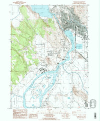 1985 Klamath Falls1985 Print · USGSKlamath Falls and its surrounding wetlands are captured here in the mid-eighties as a hub of industry and waterfowl habitat. Researchers can trace the rail lines of the Southern Pacific, locate local schools like O'Neill Sch, or explore the limits of the Lower Klamath Nat Wildlife Refuge.2 unique versions available
 - 1985 Map of Whiteline Reservoir
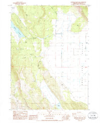 1985 Whiteline Reservoir1985 Print · USGSThe high desert basins of Klamath County are captured here in the mid-1980s, where seasonal wetlands meet steep ridges. Researchers can locate family landmarks like Gabriel Cem, Hibbert Cemetery, and the Anderson settlement.
 - 1985 Map of Altamont, 1986 Print
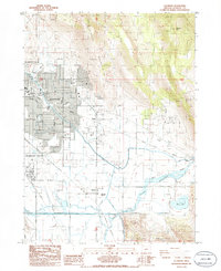 1985 Altamont1986 Print · USGSAltamont and the outskirts of Klamath Falls are captured in the mid-1980s, revealing a landscape defined by industrial growth and the basin's vital water systems. Genealogists and local historians can trace family locations near Henley, Kingsley Field, and the Eternal Hills Memorial Gardens.
 - 1985 Map of Wocus, 1988 Print
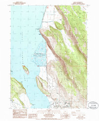 1985 Wocus1988 Print · USGSThe eastern shore of Upper Klamath Lake was a vital transport and industrial corridor in the 1980s. Trace the Southern Pacific rail line past the historic Algoma siding, the Naylox (Site), and the Oregon Institute of Technology campus.
End of results
Showing maps 1-4 of 4
Top cities near Klamath Falls
Top neighborhoods of Klamath Falls
Frequently asked questions
- What are the different types of historical maps available for Klamath Falls?
- What is the oldest map of Klamath Falls?
- Where can I purchase historical maps of Klamath Falls for my home or office?
- Where can I download high-res historical maps of Klamath Falls?
- Are there historical topographic maps available for Klamath Falls?
- Is there historical aerial imagery available for Klamath Falls?
- Where are historical maps of Klamath Falls sourced from?