Old Maps of Five Corners, Oregon for Metal Detecting
Plan your next treasure hunt with 8 historic maps of Five Corners. Find old homesites, ghost towns, trails, and gathering spots that may be lost to time — perfect for identifying promising metal detecting locations.
- Locate forgotten sites: Uncover places like long-lost settlements, abandoned rail lines, or gathering spots.
- Plan better hunts: Use map overlays combined with LiDAR or satellite views to narrow in on historically rich areas.
- Made for detectorists: Thousands of hobbyists use these maps to discover relics, coins, and hidden history.
Use these historic maps to boost your research and find new opportunities beneath the surface of Five Corners.
Five Corners, OR maps
(8)- 1955 Map of Klamath Falls, 1963 Print
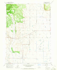
 1955 Klamath Falls1963 Print · USGSSouthern Oregon's high desert and timber country are captured here during the mid-fifties, showing the rail-dependent economies of the basin. Genealogists and researchers can locate old outposts like the Keno Guard Station, the Bly Ranger Station, and the campus of the Oregon Technical Institute.4 unique versions available
 - 1958 Map of Klamath Falls
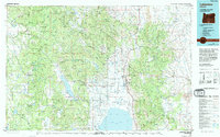
 1958 Klamath Falls1958 Print · USGSSouthern Oregon and the California borderlands are captured here in the mid-1950s during a peak era for the region's timber and rail industries. Trace the historic Klamath Indian Reservation boundaries and the rail lines of the Great Northern RR and the Oregon California and Eastern RR that connected remote towns like Bly and Beatty.3 unique versions available
 - 1964 Map of Lakeview NW, 1965 Print
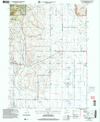
 1964 Lakeview NW1965 Print · USGSLake County agriculture and aviation come together in the mid-1960s as the Goose Lake Valley expands. Genealogists and historians can trace legacy properties like Lehmann Ranch, local rural education at Vernon Sch, and the layout of Lakeview Airport.
 - 1975 Map of Lakeview, 1994 Print
 1975 Lakeview1994 Print · USGSLakeview and the surrounding high desert terrain are captured in the mid-seventies just as the region’s timber and mining industries remained active. Researchers can trace the layout of Booth-Kelly State Park or locate the White King Mine and the Thomas Creek Work Center.
 - 2004 Map of Lakeview Airport, 2007 Print
 2004 Lakeview Airport2007 Print · USGSThe Goose Lake Valley comes alive in this early 2000s revision, showing the essential infrastructure of Lake County. Researchers can trace land ownership at Leehmann Ranch or locate the old New Idaho School and the Lakeview Airport.
 - 2014 Map of Lakeview Airport, 2014 Print
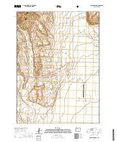
 2014 Lakeview Airport2014 Print · USGSCovers Five Corners, including Lakeview, Lake County, and other nearby areas
 - 2020 Map of Lakeview Airport, 2020 Print
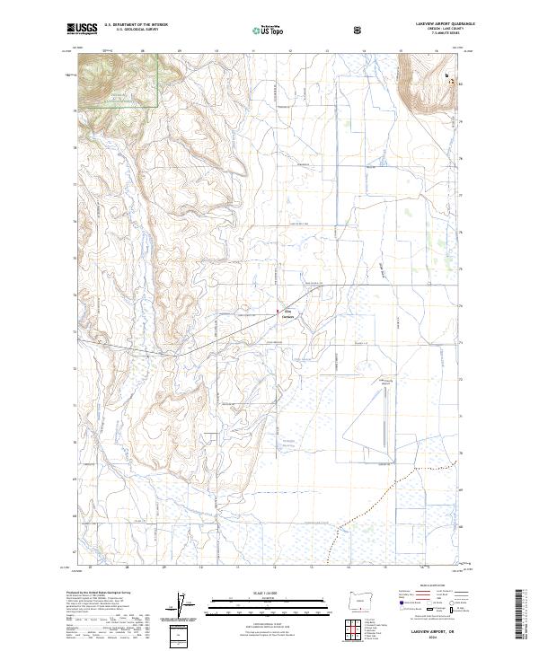
 2020 Lakeview Airport2020 Print · USGSCovers Five Corners, including Lakeview, Lake County, and other nearby areas
 - 2024 Map of Lakeview Airport, 2024 Print
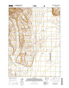
 2024 Lakeview Airport2024 Print · USGSLake County, Oregon, is captured here during a period of modern ranching and aviation expansion. Researchers can trace the sophisticated irrigation network of the North Canal and Gray Lateral or locate the rural hub at Five Corners.
End of results
Showing maps 1-8 of 8
Top cities near Five Corners
Frequently asked questions
- What are the different types of historical maps available for Five Corners?
- What is the oldest map of Five Corners?
- Where can I purchase historical maps of Five Corners for my home or office?
- Where can I download high-res historical maps of Five Corners?
- Are there historical topographic maps available for Five Corners?
- Is there historical aerial imagery available for Five Corners?
- Where are historical maps of Five Corners sourced from?