2000s (21st Century) Maps of Lakeview, Oregon
Explore 10 historic maps of Lakeview from the 2000s (21st Century). These maps offer a rare glimpse into what life looked like during the 2000s — showing old roads, neighborhoods, homes, and landmarks that have changed or disappeared over time.
Whether you're researching your family's past, planning a metal detecting trip, or studying how Lakeview's landscape evolved across the 2000s, these high-resolution maps are a powerful tool for exploring the history of this region.
- Focus on a specific era: All maps on this page are from the 2000s, giving you a focused view of this time period.
- See what’s changed: Compare century-old streets, trails, and buildings to today's modern landscape using overlays and satellite layers.
- Research with precision: Use these maps for genealogy, historical research, land use analysis, or educational projects.
- View, download, or print: Maps are fully viewable online in high resolution, and can be downloaded or printed for your own records.
Start exploring Lakeview's history through authentic maps from the 2000s. This is your window into the past.
Lakeview, OR maps
(10)- 2004 Map of Lakeview, 2007 Print
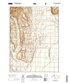
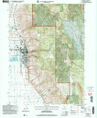 2004 Lakeview2007 Print · USGSLakeview sits at the edge of the high desert and timbered mountains during the early 2000s. Researchers can trace the local infrastructure from the IOOF Cem and Hay Sch to the nearby Warner Canyon Ski Area.
 - 2004 Map of Lakeview Airport, 2007 Print
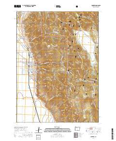
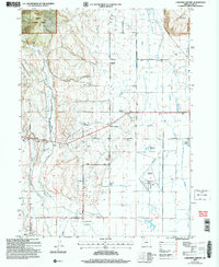 2004 Lakeview Airport2007 Print · USGSThe Goose Lake Valley comes alive in this early 2000s revision, showing the essential infrastructure of Lake County. Researchers can trace land ownership at Leehmann Ranch or locate the old New Idaho School and the Lakeview Airport.
 - 2014 Map of Lakeview, 2014 Print
 2014 Lakeview2014 Print · USGSCovers Lakeview, including Lake County, United States, and other nearby areas
 - 2014 Map of Lakeview Airport, 2014 Print
 2014 Lakeview Airport2014 Print · USGSCovers Lakeview, including Five Corners, Lake County, and other nearby areas
 - 2017 Map of Lakeview, 2017 Print
 2017 Lakeview2017 Print · USGSCovers Lakeview, including Lake County, United States, and other nearby areas
 - 2020 Map of Lakeview Airport, 2020 Print
 2020 Lakeview Airport2020 Print · USGSCovers Lakeview, including Five Corners, Lake County, and other nearby areas
 - 2020 Map of Lakeview, 2020 Print
 2020 Lakeview2020 Print · USGSCovers Lakeview, including Lake County, United States, and other nearby areas
 - 2023 Map of Lakeview, 2023 Print
 2023 Lakeview2023 Print · USGSCovers Lakeview, including Lake County, United States, and other nearby areas
 - 2024 Map of Lakeview, 2024 Print
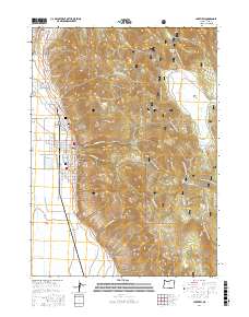
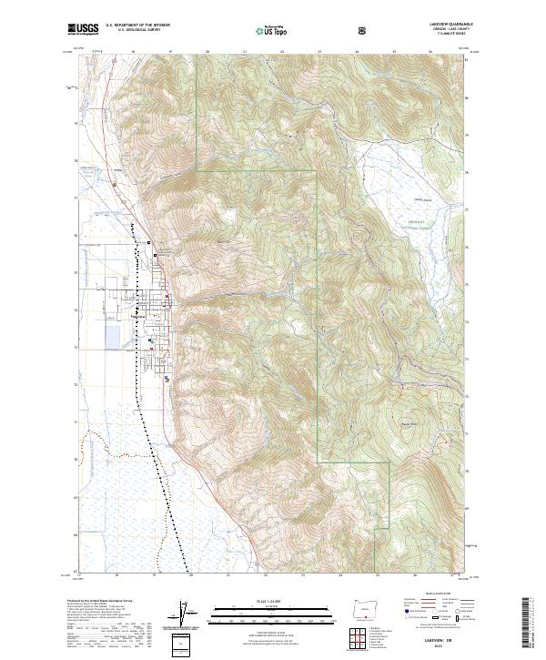
 2024 Lakeview2024 Print · USGSThe community of Lakeview and the adjacent Fremont National Forest are mapped in high detail during the early 2020s. Genealogists and historians can trace town expansion past Sunset Cem or locate geothermal landmarks at Hunter's Hot Springs.
 - 2024 Map of Lakeview Airport, 2024 Print
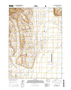
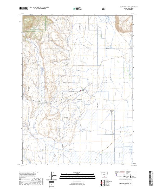 2024 Lakeview Airport2024 Print · USGSLake County, Oregon, is captured here during a period of modern ranching and aviation expansion. Researchers can trace the sophisticated irrigation network of the North Canal and Gray Lateral or locate the rural hub at Five Corners.
End of results
Showing maps 1-10 of 10
Frequently asked questions
- What are the different types of historical maps available for Lakeview?
- What is the oldest map of Lakeview?
- Where can I purchase historical maps of Lakeview for my home or office?
- Where can I download high-res historical maps of Lakeview?
- Are there historical topographic maps available for Lakeview?
- Is there historical aerial imagery available for Lakeview?
- Where are historical maps of Lakeview sourced from?