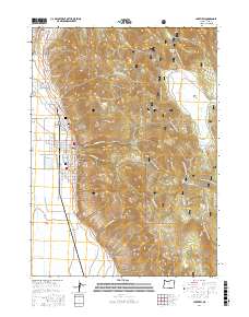
2017 Map of Lakeview
USGS Topo · Published 2017About this map
Lakeview serves as the focal point of this terrain, situated at the edge of the high desert and the wooded slopes of the Fremont National Forest. The town's grid is clearly defined, with landmarks like the Lakeview Wildlife Administrative Site and local burial grounds including Sunset Cem and the Independent Order of Odd Fellows Cem providing valuable points of reference for genealogists. To the north, Hunters Hot Springs marks a distinctive geothermal feature of the landscape.
Find a feature on this map
51 named features on this map. Tap any name to fly to it.
Don’t see what you’re looking for? This feature index may not catch every label — zoom into the map to look around manually.
Map Details
Editions of this 2017 Lakeview Map
This is the sole edition of this map. No revisions or reprints were ever made.
Other maps of this area

1955 · Klamath Falls
USGS Topo · 1:250,000

1958 · Klamath Falls
USGS Topo · 1:250,000

1964 · Lakeview NE
USGS Topo · 1:24,000

1964 · Crooked Creek Valley
USGS Topo · 1:24,000

1964 · Lakeview SW
USGS Topo · 1:24,000

1964 · Lakeview NW
USGS Topo · 1:24,000
1964 · Crane Creek
USGS Topo · 1:24,000

1964 · Big Baldy
USGS Topo · 1:24,000

1968 · Crook Peak
USGS Topo · 1:24,000
1968 · Horse Prairie
USGS Topo · 1:24,000