
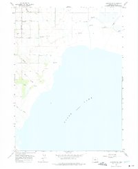
1964 Map of Lakeview SW
USGS Topo · Published 1965About this map
Goose Lake dominates the landscape of this 1964 survey, showing the fluctuating shoreline of this alkali lake in southern Oregon. The shoreline is marked by an elevation of 4701 feet, while the surrounding basin is defined by a network of drainage and water management. Numerous instances of a Flowing Well appear across the flats, particularly near the settlement of West Side, suggesting a reliance on artesian water for the cattle and agricultural operations of the era.
Find a feature on this map
14 named features on this map. Tap any name to fly to it.
Don’t see what you’re looking for? This feature index may not catch every label — zoom into the map to look around manually.
Map Details
Editions of this 1964 Lakeview SW Map
2 editions found
Other maps of this area

1886 · Alturas
USGS Topo · 1:250,000

1892 · Alturas
USGS Topo · 1:250,000

1954 · Alturas
USGS Topo · 1:250,000

1955 · Klamath Falls
USGS Topo · 1:250,000

1958 · Alturas
USGS Topo · 1:250,000

1958 · Klamath Falls
USGS Topo · 1:250,000

1962 · Alturas
USGS Topo · 1:250,000

1962 · Willow Ranch
USGS Topo · 1:62,500

1962 · South Mountain
USGS Topo · 1:62,500

1964 · Lakeview NE
USGS Topo · 1:24,000