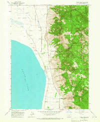
1964 Map of Crane Creek
USGS Topo · Published 1966About this map
Goose Lake dominates the western half of this mid-1960s survey, its shoreline traced by the Southern Pacific railroad line. The landscape transitions sharply from the lake's edge toward the wooded uplands of the Fremont National Forest. Along the narrow corridor between the water and the mountains, small settlements and stopping points like Cogswell and Scherrard sit near the rail line and a series of flowing wells, indicating the importance of water management and transit in this high-desert region.
Find a feature on this map
22 named features on this map. Tap any name to fly to it.
Don’t see what you’re looking for? This feature index may not catch every label — zoom into the map to look around manually.
Map Details
Editions of this 1964 Crane Creek Map
2 editions found
Other maps of this area

1886 · Alturas
USGS Topo · 1:250,000

1892 · Alturas
USGS Topo · 1:250,000

1954 · Alturas
USGS Topo · 1:250,000

1955 · Klamath Falls
USGS Topo · 1:250,000

1958 · Alturas
USGS Topo · 1:250,000

1958 · Klamath Falls
USGS Topo · 1:250,000

1962 · Alturas
USGS Topo · 1:250,000

1962 · Willow Ranch
USGS Topo · 1:62,500

1962 · Fort Bidwell
USGS Topo · 1:62,500

1964 · Lakeview NE
USGS Topo · 1:24,000