
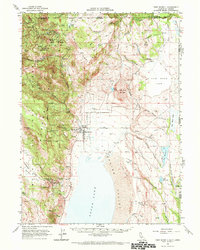
1962 Map of Fort Bidwell
USGS Topo · Published 1964About this map
The Fort Bidwell Indian Reservation and the town of Fort Bidwell occupy the eastern edge of the Warner Mountains, where the high desert meets the forested slopes of the Modoc National Forest. This 1960s survey captures a landscape defined by its remote northern mining history and high-altitude water management. To the north, the Highgrade Road snakes through the peaks, providing access to sites like the North Star Basin, Modoc Mines, and Moonlight Mines. These operations were centered around rugged terrain near Mt Vida and the Highgrade Spring.
Find a feature on this map
72 named features on this map. Tap any name to fly to it.
Don’t see what you’re looking for? This feature index may not catch every label — zoom into the map to look around manually.
Map Details
Editions of this 1962 Fort Bidwell Map
2 editions found
Other maps of this area

1886 · Alturas
USGS Topo · 1:250,000

1889 · Long Valley
USGS Topo · 1:250,000

1892 · Alturas
USGS Topo · 1:250,000

1954 · Vya
USGS Topo · 1:250,000

1954 · Alturas
USGS Topo · 1:250,000

1955 · Klamath Falls
USGS Topo · 1:250,000

1955 · Adel
USGS Topo · 1:250,000

1957 · Adel
USGS Topo · 1:250,000

1958 · Alturas
USGS Topo · 1:250,000

1958 · Klamath Falls
USGS Topo · 1:250,000