Old Maps of Alpha, Oregon for Metal Detecting
Plan your next treasure hunt with 15 historic maps of Alpha. Find old homesites, ghost towns, trails, and gathering spots that may be lost to time — perfect for identifying promising metal detecting locations.
- Locate forgotten sites: Uncover places like long-lost settlements, abandoned rail lines, or gathering spots.
- Plan better hunts: Use map overlays combined with LiDAR or satellite views to narrow in on historically rich areas.
- Made for detectorists: Thousands of hobbyists use these maps to discover relics, coins, and hidden history.
Use these historic maps to boost your research and find new opportunities beneath the surface of Alpha.
Alpha, OR maps
(15)- 1941 Map of Blachly
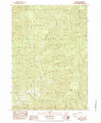
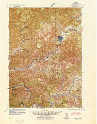 1941 Blachly1941 Print · USGSCoastal Oregon timber country comes into focus in the early 1940s, highlighting a landscape of remote sawmills and early forest management. Trace the legacy of the local lumber industry through the Logging Flume (Abandoned), the Triangle Lumber Co, and the Southern Pacific rail line.
 - 1942 Map of Blachly
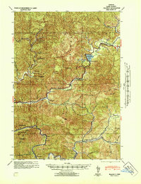 1942 Blachly1942 Print · USGSThe Oregon Coast Range in the early 1940s reveals a landscape of isolated ranches and timber camps connected by the Siuslaw River. Genealogists and historians can trace family properties like Haywire Ranch and Bessonette Ranch or locate the Triangle Lake CCC Camp and the Lyons Sch.
 - 1953 Map of Salem
 1953 Salem1953 Print · USGSMid-century Oregon comes to life through this detailed survey of the Willamette Valley and the adjacent Pacific coastline. Researchers can trace the rail lines of the Southern Pacific RR, visit rural hubs like Fairview School, or locate coastal landmarks like the Yaquina Head Lighthouse.
 - 1954 Map of Salem
 1954 Salem1954 Print · USGSMid-century Western Oregon is centered on the productive Willamette River valley as its cities and infrastructure expand toward the mountains. Genealogists and historians can trace the rail lines of the Southern Pacific RR and Oregon Electric Ry through towns like Dallas, Independence, and Brownsville.
 - 1956 Map of Blachly, 1958 Print
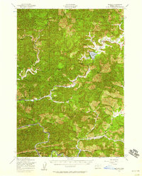 1956 Blachly1958 Print · USGSThe Oregon Coast Range in the mid-fifties shows a landscape of timber and rail, where the Southern Pacific winds through the mountains near Walton. Family historians can locate the Lyons Cem and remote schoolhouses like Deadwood Sch and Siuslaw Sch.2 unique versions available
 - 1960 Map of Salem, 1968 Print
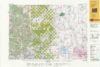
 1960 Salem1968 Print · USGSThe Willamette Valley and the surrounding mountain ranges are shown here in the 1960s during a period of significant reservoir construction. Genealogists and historians can trace rail lines like the Oregon Electric and find communities from Lincoln City on the coast to Sweet Home and Mill City in the foothills.2 unique versions available
 - 1962 Map of Salem
 1962 Salem1962 Print · USGSThe Willamette Valley and the surrounding Oregon ranges are captured here in the early sixties, showing the vital growth of the state's primary agricultural and academic corridor. Researchers can trace the mid-century footprints of Oregon State University and the University of Oregon, alongside rural landmarks like Camp Adair and Black Butte Mine.
 - 1963 Map of Salem
 1963 Salem1963 Print · USGSMid-century Oregon comes into focus as the Willamette Valley’s timber and agricultural industries meet the growing campuses of Oregon State University and the University of Oregon. Researchers can trace old rail lines like the Oregon Electric Railway and locate family plots at Siletz Cem or Dallas Cem.
 - 1980 Map of Eugene
 1980 Eugene1980 Print · USGSThe southern Willamette Valley and Coast Range are captured in the early eighties as the urban centers of Eugene and Springfield expanded. Researchers can trace the legacy of family estates and regional infrastructure through landmarks like Mahlon Sweet Airport, Fern Ridge Lake, and Junction City.
 - 1984 Map of Windy Peak
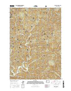
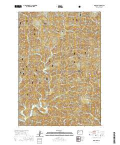
 1984 Windy Peak1984 Print · USGSWestern Oregon's timber country is documented here in the mid-1980s, showcasing the dense drainage systems of the Coast Range. Researchers can trace the rugged topography of the Siuslaw National Forest through local landmarks like Windy Peak, Buck Ridge, and Deadwood Creek.2 unique versions available
 - 1992 Map of Eugene
 1992 Eugene1992 Print · USGSThe Willamette Valley and Coast Range are captured in the early nineties, showing the growth of Eugene and Springfield. Researchers can trace timber history in the Siuslaw National Forest or locate valley settlements like Junction City and Harrisburg.
 - 2011 Map of Windy Peak, 2011 Print
 2011 Windy Peak2011 Print · USGSCovers Alpha, including Lane County, United States, and other nearby areas
 - 2017 Map of Windy Peak, 2017 Print
 2017 Windy Peak2017 Print · USGSCovers Alpha, including Lane County, United States, and other nearby areas
 - 2020 Map of Windy Peak, 2020 Print
 2020 Windy Peak2020 Print · USGSCovers Alpha, including Lane County, United States, and other nearby areas
 - 2023 Map of Windy Peak, 2023 Print
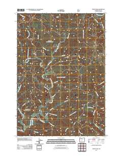
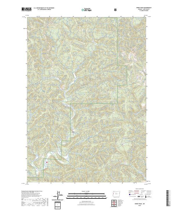 2023 Windy Peak2023 Print · USGSThe remote Coast Range timberlands of Lane County are captured here in 2023, showing the isolated settlement of Alpha deep within the Siuslaw National Forest. Trace the complex drainage of the Lobster Creek Wild and Scenic River and find family-named landmarks like Windy Peak and Wilson Ridge.
End of results
Showing maps 1-15 of 15
Frequently asked questions
- What are the different types of historical maps available for Alpha?
- What is the oldest map of Alpha?
- Where can I purchase historical maps of Alpha for my home or office?
- Where can I download high-res historical maps of Alpha?
- Are there historical topographic maps available for Alpha?
- Is there historical aerial imagery available for Alpha?
- Where are historical maps of Alpha sourced from?