1900s (20th Century) Maps of Crow, Oregon
Explore 6 historic maps of Crow from the 1900s (20th Century). These maps offer a rare glimpse into what life looked like during the 1900s — showing old roads, neighborhoods, homes, and landmarks that have changed or disappeared over time.
Whether you're researching your family's past, planning a metal detecting trip, or studying how Crow's landscape evolved across the 1900s, these high-resolution maps are a powerful tool for exploring the history of this region.
- Focus on a specific era: All maps on this page are from the 1900s, giving you a focused view of this time period.
- See what’s changed: Compare century-old streets, trails, and buildings to today's modern landscape using overlays and satellite layers.
- Research with precision: Use these maps for genealogy, historical research, land use analysis, or educational projects.
- View, download, or print: Maps are fully viewable online in high resolution, and can be downloaded or printed for your own records.
Start exploring Crow's history through authentic maps from the 1900s. This is your window into the past.
Crow, OR maps
(6)- 1942 Map of Crow, 1960 Print
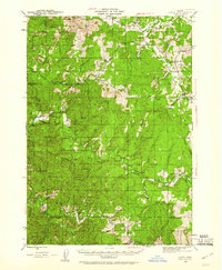 1942 Crow1960 Print · USGSLane and Douglas counties appear here during the early war years, showing a landscape shaped by timber management and remote ranching. Genealogists can locate family landmarks like Gillespie Corners, Hadleyville Sch, and the South Fork Guard Sta.2 unique versions available
 - 1945 Map of Crow
 1945 Crow1945 Print · USGSThe rural borderlands of Lane and Douglas Counties appear here at the height of the mid-century timber era. Genealogists and historians can trace family-named landmarks and remote outposts such as Gillespie Corners, Hadleyville Sch, and the Wolf Creek Store.
 - 1958 Map of Roseburg, 1960 Print
 1958 Roseburg1960 Print · USGSThe timber valleys and high volcanic peaks of Southern Oregon are captured here in the late fifties. Researchers can trace the Southern Pacific rail line through historic settlements like Cottage Grove, Yoncalla, and Oakridge near the Cascade Range crest.4 unique versions available
 - 1959 Map of Roseburg
 1959 Roseburg1959 Print · USGSThe Umpqua and Willamette valleys meet the high Cascades in this late-fifties study of Southern Oregon's timber and rail corridors. Genealogists and researchers can trace the Southern Pacific RR through historic towns like Roseburg, Yoncalla, and Cottage Grove.
 - 1979 Map of Cottage Grove
 1979 Cottage Grove1979 Print · USGSThe Oregon timber and rail corridors of the late seventies are documented here, centered on the Coast Fork Willamette River and the growing hub of Cottage Grove. Researchers can trace the path of the Southern Pacific railroad as it connects small stations like Divide, Saginaw, and Yoncalla.2 unique versions available
 - 1984 Map of Crow
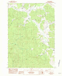 1984 Crow1984 Print · USGSIn the mid-1980s, the rural hills of western Lane County supported a network of family farms and schools centered around Crow. Researchers can trace old homesteads and burial grounds like Liles Cem and McCulloch Cem or follow the historic Territorial Highway corridor.
End of results
Showing maps 1-6 of 6
Top cities near Crow
- Eugene historical maps
- Junction City historical maps
- Veneta historical maps
- Elmira historical maps
- Malabon historical maps
Frequently asked questions
- What are the different types of historical maps available for Crow?
- What is the oldest map of Crow?
- Where can I purchase historical maps of Crow for my home or office?
- Where can I download high-res historical maps of Crow?
- Are there historical topographic maps available for Crow?
- Is there historical aerial imagery available for Crow?
- Where are historical maps of Crow sourced from?