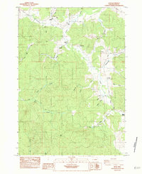
1984 Map of Crow
USGS Topo · Published 1984About this map
Crow and its surrounding countryside in Lane County are defined by the convergence of several major creek drainages, including Crow Creek, Coyote Creek, and Battle Creek. The landscape here reflects a settled agricultural and residential pattern along the foothills, with prominent family-named landmarks such as Crow Hill and Wolf Point anchoring the topography. The local community infrastructure is well-represented, featuring the Crow Jr High Sch and Crow High Sch, while several smaller rural hubs like Hadleyville and Gillespie Corners mark key intersections. Genealogists will find significant value in the distribution of family and community burial grounds, including Liles Cem, Gates Cem, and Heatherly Cem. Industrial activity is evidenced by a Quarry and a Borrow Pit, while the transportation network is dominated by the north-south Territorial Highway.
Find a feature on this map
37 named features on this map. Tap any name to fly to it.
Don’t see what you’re looking for? This feature index may not catch every label — zoom into the map to look around manually.
Map Details
Editions of this 1984 Crow Map
This is the sole edition of this map. No revisions or reprints were ever made.
Other maps of this area

1909 · Elmira
USGS Topo · 1:62,500

1910 · Eugene
USGS Topo · 1:62,500

1921 · Cottage Grove
USGS Topo · 1:62,500

1922 · Elmira
USGS Topo · 1:62,500

1940 · Eugene
USGS Topo · 1:62,500

1942 · Elmira
USGS Topo · 1:62,500

1942 · Crow
USGS Topo · 1:62,500

1945 · Crow
USGS Topo · 1:62,500

1946 · Eugene
USGS Topo · 1:62,500

1949 · Eugene
USGS Topo · 1:62,500