1900s (20th Century) Maps of South Beach, Newport
Explore 10 historic maps of South Beach from the 1900s (20th Century). These maps offer a rare glimpse into what life looked like during the 1900s — showing old roads, neighborhoods, homes, and landmarks that have changed or disappeared over time.
Whether you're researching your family's past, planning a metal detecting trip, or studying how South Beach's landscape evolved across the 1900s, these high-resolution maps are a powerful tool for exploring the history of this region.
- Focus on a specific era: All maps on this page are from the 1900s, giving you a focused view of this time period.
- See what’s changed: Compare century-old streets, trails, and buildings to today's modern landscape using overlays and satellite layers.
- Research with precision: Use these maps for genealogy, historical research, land use analysis, or educational projects.
- View, download, or print: Maps are fully viewable online in high resolution, and can be downloaded or printed for your own records.
Start exploring South Beach's history through authentic maps from the 1900s. This is your window into the past.
South Beach, Newport maps
(10)- 1942 Map of Yaquina
 1942 Yaquina1942 Print · USGSThe Oregon coast at the start of the 1940s reveals a maritime landscape centered on the working waterfront of Newport. Researchers can trace the development of the Oregon Coast Highway past landmarks like Yaquina Head, the U S Coast Guard Station, and Oysterville.2 unique versions available
 - 1953 Map of Salem
 1953 Salem1953 Print · USGSMid-century Oregon comes to life through this detailed survey of the Willamette Valley and the adjacent Pacific coastline. Researchers can trace the rail lines of the Southern Pacific RR, visit rural hubs like Fairview School, or locate coastal landmarks like the Yaquina Head Lighthouse.
 - 1954 Map of Salem
 1954 Salem1954 Print · USGSMid-century Western Oregon is centered on the productive Willamette River valley as its cities and infrastructure expand toward the mountains. Genealogists and historians can trace the rail lines of the Southern Pacific RR and Oregon Electric Ry through towns like Dallas, Independence, and Brownsville.
 - 1957 Map of Yaquina, 1958 Print
 1957 Yaquina1958 Print · USGSThe Oregon central coast in the late fifties shows a landscape of growing beach towns and riverside settlements. Genealogists and historians can trace local landmarks like Lincoln Grange, the old Oysterville site, and the historic Yaquina Head lighthouse.5 unique versions available
 - 1960 Map of Salem, 1968 Print
 1960 Salem1968 Print · USGSThe Willamette Valley and the surrounding mountain ranges are shown here in the 1960s during a period of significant reservoir construction. Genealogists and historians can trace rail lines like the Oregon Electric and find communities from Lincoln City on the coast to Sweet Home and Mill City in the foothills.2 unique versions available
 - 1962 Map of Salem
 1962 Salem1962 Print · USGSThe Willamette Valley and the surrounding Oregon ranges are captured here in the early sixties, showing the vital growth of the state's primary agricultural and academic corridor. Researchers can trace the mid-century footprints of Oregon State University and the University of Oregon, alongside rural landmarks like Camp Adair and Black Butte Mine.
 - 1963 Map of Salem
 1963 Salem1963 Print · USGSMid-century Oregon comes into focus as the Willamette Valley’s timber and agricultural industries meet the growing campuses of Oregon State University and the University of Oregon. Researchers can trace old rail lines like the Oregon Electric Railway and locate family plots at Siletz Cem or Dallas Cem.
 - 1975 Map of Yaquina SE, 1979 Print
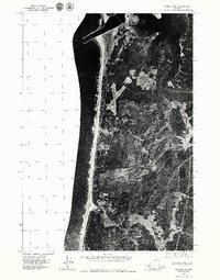 1975 Yaquina SE1979 Print · USGSThe Oregon coast in the mid-1970s reveals a landscape of dense timber and tidal estuaries just south of the harbor entrance. Researchers can trace the development of Southbeach and study the original banks of the Yaquina River before decades of modern change.
 - 1981 Map of Newport
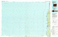 1981 Newport1981 Print · USGSThe Oregon coast in the early eighties shows a landscape of busy estuaries and established seaside communities from Lincoln City down to Southbench. Genealogists and local historians can trace the development of towns like Depoe Bay, locate family-named landmarks like McLean Point, or explore the many inlets of Yaquina Bay.
 - 1984 Map of Newport South, 1985 Print
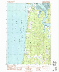 1984 Newport South1985 Print · USGSThe Oregon coast south of Newport in the mid-eighties reveals a landscape of maritime research, tidal sloughs, and emerging beach communities. Trace the development of South Beach, the Marine Science Center, and riverside hamlets like Winant and Oysterville.2 unique versions available
End of results
Showing maps 1-10 of 10
Frequently asked questions
- What are the different types of historical maps available for South Beach?
- What is the oldest map of South Beach?
- Where can I purchase historical maps of South Beach for my home or office?
- Where can I download high-res historical maps of South Beach?
- Are there historical topographic maps available for South Beach?
- Is there historical aerial imagery available for South Beach?
- Where are historical maps of South Beach sourced from?