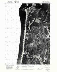
1975 Map of Yaquina SE
USGS Topo · Published 1979About this map
The Yaquina River meanders through the eastern portion of this coastal landscape, revealing the intricate tidelands and marshy inlets that defined the area in the mid-1970s. This orthophotoquad captures the interface between the Pacific shoreline and the wooded interior, where the small settlement of Southbeach serves as the primary developed hub near the northern jetty. The photographic detail offers a clear view of the local infrastructure, including a prominent x-shaped airfield and the early road network cutting through the dense forest. By combining aerial imagery with geographic precision, the map documents the estuary's natural state before late-century development, making it a valuable tool for tracing land use and coastal changes along this stretch of the Oregon coast.
Find a feature on this map
2 named features on this map. Tap any name to fly to it.
Don’t see what you’re looking for? This feature index may not catch every label — zoom into the map to look around manually.
Map Details
Editions of this 1975 Yaquina SE Map
This is the sole edition of this map. No revisions or reprints were ever made.
Other maps of this area

1922 · Waldport
USGS Topo · 1:62,500

1942 · Waldport
USGS Topo · 1:62,500

1942 · Yaquina
USGS Topo · 1:62,500

1942 · Tidewater
USGS Topo · 1:62,500

1942 · Toledo
USGS Topo · 1:62,500

1953 · Salem
USGS Topo · 1:250,000

1954 · Salem
USGS Topo · 1:250,000

1956 · Tidewater
USGS Topo · 1:62,500

1956 · Waldport
USGS Topo · 1:62,500

1957 · Yaquina
USGS Topo · 1:62,500