Old Maps of Arock, Oregon for Hiking & Exploration
Hike through history with 6 historic maps of Arock. Explore old trails, ghost towns, and forgotten backroads — perfect for outdoor adventurers and local explorers.
- Rediscover forgotten places: Map out old mining camps, roads, and footpaths that no longer exist on modern maps.
- Layer with modern tools: Combine with LiDAR or satellite views to plan hikes through historical terrain.
- Made for exploration: Popular among hikers, overlanders, and local history lovers.
Use these maps to find adventure and explore the hidden past of Arock.
Arock, OR maps
(6)- 1955 Map of Jordan Valley, 1963 Print
 1955 Jordan Valley1963 Print · USGSThe high desert of Malheur County comes alive in the mid-1950s, showing the isolated ranching outposts and deep canyons along the Idaho border. Researchers can trace the remote reaches of the Owyhee River, the cattle town of Jordan Valley, and mining landmarks like War Eagle Mountain.3 unique versions available
 - 1957 Map of Jordan Valley
 1957 Jordan Valley1957 Print · USGSThe high-desert borderlands of Oregon and Idaho appear in the mid-fifties as a world of remote cattle ranches and mining claims. Researchers can trace historic family-named locations like Bowden Ranch and Riddle alongside the South Mountain Mining Company.
 - 1958 Map of Jordan Valley
 1958 Jordan Valley1958 Print · USGSSoutheast Oregon and Southwest Idaho are documented here during the mid-fifties, showing a landscape of remote cattle ranches and volcanic badlands. Genealogists and historians can trace family operations like the Bowden Ranch or locate the Pleasant Valley School and the South Mountain Mining Company.2 unique versions available
 - 1972 Map of Arock, 1975 Print
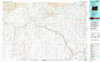
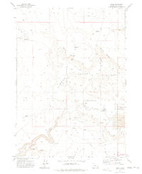 1972 Arock1975 Print · USGSThe Jordan Valley in the early 1970s reveals a ranching landscape centered on the settlement of Arock. Researchers can trace the water-management network of the North Side Canal and find local landmarks like Jones Sch and the Sheep Ranch.
 - 1994 Map of Jordan Valley
 1994 Jordan Valley1994 Print · USGSThe high desert of Malheur County meets the Idaho border in the mid-1990s, where ranching life centers on the Owyhee River drainage. Genealogists and local historians can trace the foundations of isolated settlements like Arock and Danner or the critical water works of Antelope Reservoir.2 unique versions available
 - 2024 Map of Arock, 2024 Print
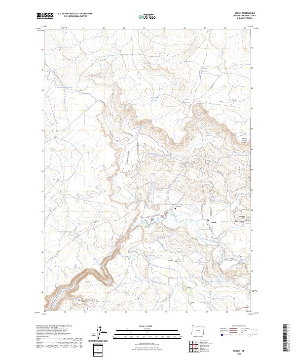 2024 Arock2024 Print · USGSThe high desert ranching country of Malheur County is captured here in the early twenty-first century, centered on the community of Arock. Genealogists and local historians can locate the Arock Cem and trace livestock water systems through No Catchum Reservoir and the South Side Canal.
End of results
Showing maps 1-6 of 6
Frequently asked questions
- What are the different types of historical maps available for Arock?
- What is the oldest map of Arock?
- Where can I purchase historical maps of Arock for my home or office?
- Where can I download high-res historical maps of Arock?
- Are there historical topographic maps available for Arock?
- Is there historical aerial imagery available for Arock?
- Where are historical maps of Arock sourced from?