Old Maps of Ukiah, Oregon for Hiking & Exploration
Hike through history with 8 historic maps of Ukiah. Explore old trails, ghost towns, and forgotten backroads — perfect for outdoor adventurers and local explorers.
- Rediscover forgotten places: Map out old mining camps, roads, and footpaths that no longer exist on modern maps.
- Layer with modern tools: Combine with LiDAR or satellite views to plan hikes through historical terrain.
- Made for exploration: Popular among hikers, overlanders, and local history lovers.
Use these maps to find adventure and explore the hidden past of Ukiah.
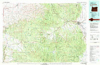
Ukiah, OR maps
(8)- 1953 Map of Pendleton, 1957 Print
 1953 Pendleton1957 Print · USGSNortheastern Oregon and the Columbia River frontier are captured here in the early fifties, a time of massive federal infrastructure projects. Researchers can trace the historic route of The Old Oregon Trail as it passes near the Umatilla Ordnance Depot and the new McNary Dam.4 unique versions available
 - 1956 Map of Pendleton
 1956 Pendleton1956 Print · USGSNortheastern Oregon’s high plateau and timbered peaks appear here in the mid-fifties, during a time of major military and hydroelectric development. Trace the path of The Old Oregon Trail alongside modern landmarks like McNary Dam and the Umatilla Ordnance Depot.
 - 1967 Map of Ukiah, 1970 Print
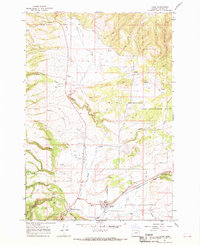 1967 Ukiah1970 Print · USGSUkiah and the surrounding Umatilla County highlands are captured here in the late sixties as a landscape of timber and trout streams. Genealogists and historians can locate the Ukiah townsite, the cemetery, and old forest outposts like the Lookout and Albee.2 unique versions available
 - 1979 Map of La Grande, 1980 Print
 1979 La Grande1980 Print · USGSNorthwestern Oregon’s mountain corridors are captured here in the late seventies, showing the rail and river networks through the Blue Mountains. Trace the Old Emigrant Road, locate the Aurelia Mine, or explore the Starkey Experimental Forest.2 unique versions available
 - 1995 Map of Ukiah, 1998 Print
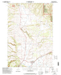 1995 Ukiah1998 Print · USGSThe high country of Umatilla County in the mid-1990s is captured here, showing the intersection of forest service lands and small mountain communities. Researchers can trace the layout of Ukiah and Albee or locate the local Cemetery and Landing Strip.
 - 2011 Map of Ukiah, 2011 Print
 2011 Ukiah2011 Print · USGSCovers Ukiah, including Umatilla County, United States, and other nearby areas
 - 2020 Map of Ukiah, 2020 Print
 2020 Ukiah2020 Print · USGSCovers Ukiah, including Umatilla County, United States, and other nearby areas
 - 2024 Map of Ukiah, 2024 Print
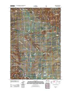
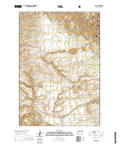
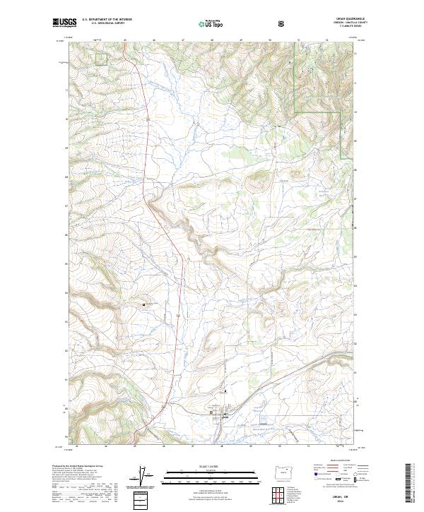 2024 Ukiah2024 Print · USGSUkiah and the surrounding canyons of Umatilla County are captured in this recent survey of the Blue Mountain foothills. Researchers can pinpoint property locations along Dixie Ranch Rd or trace local lineage at Sturdivant Cem and Ukiah Cem.
End of results
Showing maps 1-8 of 8
Frequently asked questions
- What are the different types of historical maps available for Ukiah?
- What is the oldest map of Ukiah?
- Where can I purchase historical maps of Ukiah for my home or office?
- Where can I download high-res historical maps of Ukiah?
- Are there historical topographic maps available for Ukiah?
- Is there historical aerial imagery available for Ukiah?
- Where are historical maps of Ukiah sourced from?