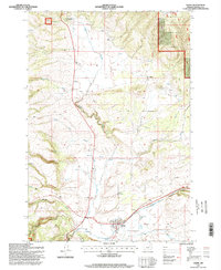
1995 Map of Ukiah
USGS Topo · Published 1998About this map
Ukiah sits at the southern edge of this mid-1990s survey, marking a small pocket of settlement where the Blue Mountain Scenic Byway meets the waters of Camas Creek. The landscape transitions from the protected timberlands of the Umatilla National Forest into a complex drainage system defined by the West Fork Snipe Creek and North Fork Snipe Creek. To the north, the small community of Albee appears near Battle Mountain Forest Wayside, illustrating the remote character of this region of Umatilla County.
Find a feature on this map
21 named features on this map. Tap any name to fly to it.
Don’t see what you’re looking for? This feature index may not catch every label — zoom into the map to look around manually.
Map Details
Editions of this 1995 Ukiah Map
This is the sole edition of this map. No revisions or reprints were ever made.
Other maps of this area

1953 · Pendleton
USGS Topo · 1:250,000

1956 · Pendleton
USGS Topo · 1:250,000

1967 · Ukiah SE
USGS Topo · 1:24,000

1967 · Granite Meadows
USGS Topo · 1:24,000

1967 · Bridge Creek
USGS Topo · 1:24,000

1967 · Carney Butte
USGS Topo · 1:24,000

1967 · Ukiah
USGS Topo · 1:24,000

1967 · Owens Butte
USGS Topo · 1:24,000

1968 · Gurdane
USGS Topo · 1:24,000

1969 · Sugarbowl Creek
USGS Topo · 1:24,000