
1967 Map of Carney Butte
USGS Topo · Published 1970About this map
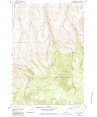
Battle Mountain State Park anchors this portion of the Blue Mountains in the late 1960s, centered around the Battle Mountain Summit and a nearby Picnic Area. The landscape is defined by the transition from the high, timbered reaches of the Umatilla National Forest to a complex network of deep-cut drainages including Beale Canyon, Campbell Canyon, and Robinson Canyon. High-elevation infrastructure is visible at Carney Butte, which supported a Lookout Tower, and a separate Radio Tower to the southwest.
Find a feature on this map
39 named features on this map. Tap any name to fly to it.
Don’t see what you’re looking for? This feature index may not catch every label — zoom into the map to look around manually.
Map Details
Editions of this 1967 Carney Butte Map
2 editions found
Other maps of this area

1953 · Pendleton
USGS Topo · 1:250,000

1956 · Pendleton
USGS Topo · 1:250,000

1967 · Nye
USGS Topo · 1:24,000

1967 · Granite Meadows
USGS Topo · 1:24,000

1967 · Pilot Rock
USGS Topo · 1:24,000

1967 · Ukiah
USGS Topo · 1:24,000

1967 · Owens Butte
USGS Topo · 1:24,000

1968 · Gurdane
USGS Topo · 1:24,000
1968 · Vinson
USGS Topo · 1:24,000

1969 · Sugarbowl Creek
USGS Topo · 1:24,000