
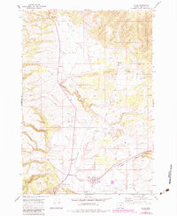
1967 Map of Ukiah
USGS Topo · Published 1970About this map
Ukiah serves as the primary settlement on this portion of the Umatilla National Forest, situated along the winding course of Camas Creek. The landscape of the late 1960s is defined by a network of watercourses, including Snipe Creek and Owens Creek, which drain the timbered uplands and open canyons. Traces of human activity are scattered across the terrain, from the small community of Albee to a small cemetery and a remote Landing Strip north of the main town. The presence of a Lookout and the Ukiah-Dale Wayside highlights the area's dual role as a managed forest resource and a destination for travelers. Numerous benchmarks and jeep trails throughout Johnson Canyon and the surrounding forks suggest a history of surveying and local forestry access typical of this section of Umatilla County during the mid-20th century.
Find a feature on this map
32 named features on this map. Tap any name to fly to it.
Don’t see what you’re looking for? This feature index may not catch every label — zoom into the map to look around manually.
Map Details
Editions of this 1967 Ukiah Map
2 editions found
Other maps of this area

1953 · Pendleton
USGS Topo · 1:250,000

1956 · Pendleton
USGS Topo · 1:250,000

1967 · Ukiah SE
USGS Topo · 1:24,000

1967 · Granite Meadows
USGS Topo · 1:24,000

1967 · Bridge Creek
USGS Topo · 1:24,000

1967 · Carney Butte
USGS Topo · 1:24,000

1967 · Owens Butte
USGS Topo · 1:24,000

1968 · Gurdane
USGS Topo · 1:24,000

1969 · Sugarbowl Creek
USGS Topo · 1:24,000

1969 · Deerhorn Creek
USGS Topo · 1:24,000