
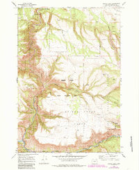
1967 Map of Bridge Creek
USGS Topo · Published 1969About this map
Umatilla National Forest dominates this section of the Blue Mountains, where the deep drainage of the North Fork John Day River carves through the southern portion of the map. The landscape is defined by its complex hydrology, with numerous named water sources such as Skull Spring, Meengs Spring, and Clark Spring providing critical points in an otherwise arid plateau. The high Bridge Creek Flats stand above a network of erosion-cut ravines including Johnson Canyon and Day Canyon. Human presence is sparse and focused on transit and resource extraction, evidenced by the Ukiah-Dale Wayside along the northern boundary and a Gravel Pit near the headwaters. A single Footbridge spans the river near the confluence of Camas Creek, marking a vital crossing point in a region primarily accessed by a simple Trail system and unimproved roads.
Find a feature on this map
23 named features on this map. Tap any name to fly to it.
Don’t see what you’re looking for? This feature index may not catch every label — zoom into the map to look around manually.
Map Details
Editions of this 1967 Bridge Creek Map
2 editions found
Other maps of this area

1950 · Ritter
USGS Topo · 1:62,500

1951 · Dale
USGS Topo · 1:62,500

1952 · Ritter
USGS Topo · 1:62,500

1953 · Pendleton
USGS Topo · 1:250,000

1955 · Canyon City
USGS Topo · 1:250,000

1956 · Pendleton
USGS Topo · 1:250,000

1959 · Canyon City
USGS Topo · 1:250,000

1967 · Ukiah SE
USGS Topo · 1:24,000

1967 · Ukiah
USGS Topo · 1:24,000

1967 · Owens Butte
USGS Topo · 1:24,000