
1950 Map of Ritter
USGS Topo · Published 1964About this map
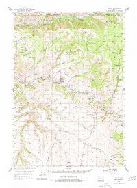
The Middle Fork John Day River and North Fork John Day River dominate this mid-century landscape in the high country of Eastern Oregon. The settlement of Elk Grove and the small community infrastructure around the Ritter Sch provide a look at rural life within the Umatilla National Forest just after the war. A clear pattern of mid-20th-century resource extraction and community management is evident, marked by the presence of a Lumber Mill near the river and the Ritter Grange nearby. Social and educational life is anchored by remote landmarks like Threemile School and Range School, while the Ritter Cemetery offers a point of interest for genealogists tracing local families. The terrain is deeply incised by countless drainages such as Eightmile Creek and Twelvemile Creek, flowing toward the major river forks.
Find a feature on this map
67 named features on this map. Tap any name to fly to it.
Don’t see what you’re looking for? This feature index may not catch every label — zoom into the map to look around manually.
Map Details
Editions of this 1950 Ritter Map
2 editions found
Other maps of this area

1949 · Long Creek
USGS Topo · 1:62,500

1949 · Susanville
USGS Topo · 1:62,500

1951 · Susanville
USGS Topo · 1:62,500

1951 · Long Creek
USGS Topo · 1:62,500

1951 · Courtrock
USGS Topo · 1:62,500

1951 · Monument
USGS Topo · 1:62,500

1951 · Dale
USGS Topo · 1:62,500

1952 · Ritter
USGS Topo · 1:62,500

1953 · Pendleton
USGS Topo · 1:250,000

1955 · Canyon City
USGS Topo · 1:250,000