
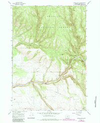
1967 Map of Owens Butte
USGS Topo · Published 1970About this map
Umatilla National Forest dominates this 1960s landscape, where deep drainages and high ridges define the central Blue Mountains. The map reveals a land utilized for both recreation and industry, centered around the winding course of Camas Creek. Along this waterway, a Gaging Station monitors flow, while Highway 244 provides the primary access route through the canyon. For those studying the mid-century infrastructure of the forest, the map identifies specific recreational sites like Lane Creek Campground and Bear Wallow Creek Campground, alongside industrial footprints such as a Quarry. Numerous water sources, including Owens Creek, Cable Creek, and a network of unnamed springs, emphasize the hydrological importance of this terrain. The presence of a Jeep Trail cutting across high elevations near Owens Butte suggests the rugged nature of forest management and access during this era.
Find a feature on this map
19 named features on this map. Tap any name to fly to it.
Don’t see what you’re looking for? This feature index may not catch every label — zoom into the map to look around manually.
Map Details
Editions of this 1967 Owens Butte Map
2 editions found
Other maps of this area

1953 · Pendleton
USGS Topo · 1:250,000

1956 · Pendleton
USGS Topo · 1:250,000

1967 · Ukiah SE
USGS Topo · 1:24,000

1967 · Lehman Springs
USGS Topo · 1:24,000

1967 · Granite Meadows
USGS Topo · 1:24,000

1967 · Pearson Ridge
USGS Topo · 1:24,000

1967 · Bridge Creek
USGS Topo · 1:24,000

1967 · Carney Butte
USGS Topo · 1:24,000

1967 · Ukiah
USGS Topo · 1:24,000
1967 · Tamarack Gulch
USGS Topo · 1:24,000