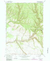
1967 Map of Owens Butte
USGS Topo · Published 1984About this map
Owens Butte rises above a landscape defined by the deep drainage networks of the Umatilla National Forest in northeastern Oregon. This 1967 survey, with revisions from the early 1980s, highlights the essential role of water and forest management in this remote region. The confluence of Camas Creek and Lane Creek serves as a focal point for activity, hosting the Lane Creek Campground and a downstream Gaging Station. A Quarry and numerous segments of Jeep Trail indicate the industrial and recreational access points through the timberland. The map's detailed topography reveals the steep draws of Hideaway and the winding courses of Owens Creek and Cable Creek, providing a clear view of the forest's hydrological structure before more modern developments altered these backcountry corridors.
Find a feature on this map
18 named features on this map. Tap any name to fly to it.
Don’t see what you’re looking for? This feature index may not catch every label — zoom into the map to look around manually.
Map Details
Editions of this 1967 Owens Butte Map
2 editions found
Other maps of this area

1953 · Pendleton
USGS Topo · 1:250,000

1956 · Pendleton
USGS Topo · 1:250,000

1967 · Ukiah SE
USGS Topo · 1:24,000

1967 · Lehman Springs
USGS Topo · 1:24,000

1967 · Granite Meadows
USGS Topo · 1:24,000

1967 · Pearson Ridge
USGS Topo · 1:24,000

1967 · Bridge Creek
USGS Topo · 1:24,000

1967 · Carney Butte
USGS Topo · 1:24,000

1967 · Ukiah
USGS Topo · 1:24,000

1967 · Owens Butte
USGS Topo · 1:24,000