
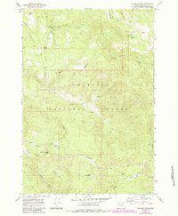
1967 Map of Pearson Ridge
USGS Topo · Published 1969About this map
Umatilla National Forest encompasses this entire high-elevation landscape in the late 1960s, defined by the drainage systems of Hidaway Creek and North Fork Cable Creek. The map documents a rugged wilderness managed for conservation and forestry, punctuated by administrative and utility markers such as the Pearson Guard Station and a prominent Lookout Tower standing atop the namesake Pearson Ridge.
Find a feature on this map
31 named features on this map. Tap any name to fly to it.
Don’t see what you’re looking for? This feature index may not catch every label — zoom into the map to look around manually.
Map Details
Editions of this 1967 Pearson Ridge Map
2 editions found
Other maps of this area

1951 · Dale
USGS Topo · 1:62,500

1951 · Desolation Butte
USGS Topo · 1:62,500

1953 · Pendleton
USGS Topo · 1:250,000

1955 · Canyon City
USGS Topo · 1:250,000

1956 · Pendleton
USGS Topo · 1:250,000

1959 · Canyon City
USGS Topo · 1:250,000

1967 · Ukiah SE
USGS Topo · 1:24,000

1967 · Tower Mtn
USGS Topo · 1:24,000

1967 · Sullivan Gulch
USGS Topo · 1:24,000

1967 · Lehman Springs
USGS Topo · 1:24,000