
1967 Map of Sullivan Gulch
USGS Topo · Published 1969About this map
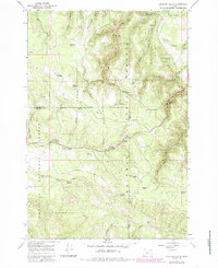
Starkey Experimental Forest dominates this high-country landscape, where researchers and foresters established the Experimental Forest Headquarters to study the complex ecology of the Blue Mountains. The terrain is a network of named springs and seasonal drainages, which were critical for managing both wildlife and livestock within the Umatilla National Forest and Whitman National Forest boundaries.
Find a feature on this map
50 named features on this map. Tap any name to fly to it.
Don’t see what you’re looking for? This feature index may not catch every label — zoom into the map to look around manually.
Map Details
Editions of this 1967 Sullivan Gulch Map
2 editions found
Other maps of this area

1953 · Pendleton
USGS Topo · 1:250,000

1956 · Pendleton
USGS Topo · 1:250,000

1964 · Mc Intyre Creek
USGS Topo · 1:24,000

1965 · Marley Creek
USGS Topo · 1:24,000

1965 · Fly Valley
USGS Topo · 1:24,000

1967 · Tower Mtn
USGS Topo · 1:24,000

1967 · Lehman Springs
USGS Topo · 1:24,000

1967 · Bally Mountain
USGS Topo · 1:24,000

1967 · Pearson Ridge
USGS Topo · 1:24,000
1967 · Tamarack Gulch
USGS Topo · 1:24,000