
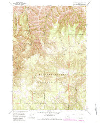
1967 Map of Bally Mountain
USGS Topo · Published 1969About this map
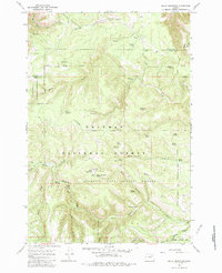
Bally Mountain serves as a prominent high point in this 1967 survey of the borderlands between Umatilla and Union counties. The landscape is defined by the convergence of the Umatilla National Forest and Whitman National Forest, with a significant portion of the terrain dedicated to the Starkey Experimental Forest. Near the summit, a Lookout Tower and Bally Camp mark human activity in a region dominated by deep drainages like Cougar Canyon and The Narrows. A notable historical feature is the Old Indian National Treaty Boundary, which cuts across the northern third of the map, while an Old RR Grade in the southeast corner provides a trace of former industrial transport through the hills. Numerous water sources, including Wildhorse Spring and Horseshoe Spring, indicate the hydrological importance of this upland area to the surrounding drainages.
Find a feature on this map
41 named features on this map. Tap any name to fly to it.
Don’t see what you’re looking for? This feature index may not catch every label — zoom into the map to look around manually.
Map Details
Editions of this 1967 Bally Mountain Map
Other maps of this area

1953 · Pendleton
USGS Topo · 1:250,000

1956 · Pendleton
USGS Topo · 1:250,000

1963 · Meacham Lake
USGS Topo · 1:24,000

1964 · Mc Intyre Creek
USGS Topo · 1:24,000

1965 · Marley Creek
USGS Topo · 1:24,000
1967 · Bassey Creek
USGS Topo · 1:24,000

1967 · Sullivan Gulch
USGS Topo · 1:24,000

1967 · Lehman Springs
USGS Topo · 1:24,000
1967 · Sevenmile Creek
USGS Topo · 1:24,000
1967 · Tamarack Gulch
USGS Topo · 1:24,000