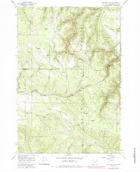
1967 Map of Sullivan Gulch
USGS Topo · Published 1985About this map
The Starkey Experimental Forest dominates this landscape along the border of Union and Umatilla counties, providing a window into forest management practices during the mid-1960s. The topographic detail shows the Experimental Forest Headquarters and a nearby Reservoir, which serve as the hub for scientific study in this timber-rich region. The area is heavily intersected by both the Whitman National Forest and Umatilla National Forest, creating a complex patchwork of federal land designations.
Find a feature on this map
41 named features on this map. Tap any name to fly to it.
Don’t see what you’re looking for? This feature index may not catch every label — zoom into the map to look around manually.
Map Details
Editions of this 1967 Sullivan Gulch Map
2 editions found
Other maps of this area

1953 · Pendleton
USGS Topo · 1:250,000

1956 · Pendleton
USGS Topo · 1:250,000

1964 · Mc Intyre Creek
USGS Topo · 1:24,000

1965 · Marley Creek
USGS Topo · 1:24,000

1965 · Fly Valley
USGS Topo · 1:24,000

1967 · Tower Mtn
USGS Topo · 1:24,000

1967 · Sullivan Gulch
USGS Topo · 1:24,000

1967 · Lehman Springs
USGS Topo · 1:24,000

1967 · Bally Mountain
USGS Topo · 1:24,000

1967 · Pearson Ridge
USGS Topo · 1:24,000