
1967 Map of Nye
USGS Topo · Published 1969About this map
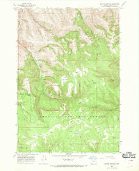
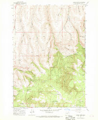
Nye sits at the head of a complex canyon network in the Blue Mountains foothills, where the intersection of Jack Canyon and several smaller draws defines the local topography. This 1967 field-checked survey reveals an upland landscape dominated by seasonal water sources and livestock infrastructure, evidenced by numerous named springs such as Upper Rugg Spring, Casteel Spring, and Windmill Spring. The high ground of Whittaker Flats provides a stark contrast to the deeply incised drainages like Rugg Canyon and Beale Canyon that carve through the basalt layers of the Umatilla region.
Find a feature on this map
27 named features on this map. Tap any name to fly to it.
Don’t see what you’re looking for? This feature index may not catch every label — zoom into the map to look around manually.
Map Details
Editions of this 1967 Nye Map
This is the sole edition of this map. No revisions or reprints were ever made.
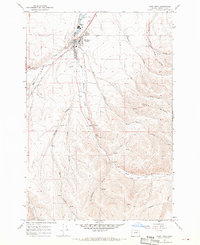
Other maps of this area

1908 · Umatilla
USGS Topo · 1:125,000

1935 · Pendleton
USGS Topo · 1:125,000

1953 · Pendleton
USGS Topo · 1:250,000

1956 · Pendleton
USGS Topo · 1:250,000

1966 · Mc Kay Reservoir
USGS Topo · 1:24,000

1966 · Coombs Canyon
USGS Topo · 1:24,000
1967 · Granite Meadows
USGS Topo · 1:24,000
1967 · Carney Butte
USGS Topo · 1:24,000
1967 · Pilot Rock
USGS Topo · 1:24,000
1968 · Echo SE
USGS Topo · 1:24,000