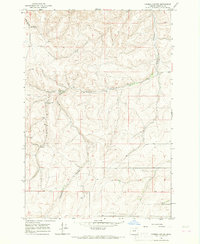
1966 Map of Coombs Canyon
USGS Topo · Published 1968About this map
Coombs Canyon and its branching draws define this high-desert portion of Umatilla County, where the landscape is shaped by deep drainage networks. The mapping reflects a working landscape of ranching and resource extraction, anchored by the Cross Ranch and supported by critical water sources like Crazy John Spring, Mud Spring, and the Twin Wells. These springs and wells are the lifeblood of the terrain, dictating the placement of primitive roads and livestock infrastructure in an otherwise arid environment.
Find a feature on this map
11 named features on this map. Tap any name to fly to it.
Don’t see what you’re looking for? This feature index may not catch every label — zoom into the map to look around manually.
Map Details
Editions of this 1966 Coombs Canyon Map
This is the sole edition of this map. No revisions or reprints were ever made.
Other maps of this area

1908 · Umatilla
USGS Topo · 1:125,000

1935 · Pendleton
USGS Topo · 1:125,000

1953 · Pendleton
USGS Topo · 1:250,000

1956 · Pendleton
USGS Topo · 1:250,000

1966 · Mc Kay Reservoir
USGS Topo · 1:24,000

1966 · Pendleton
USGS Topo · 1:24,000
1966 · Barnhart
USGS Topo · 1:24,000

1967 · Nye
USGS Topo · 1:24,000

1967 · Pilot Rock
USGS Topo · 1:24,000
1968 · Echo SE
USGS Topo · 1:24,000