Old Maps of Elgin, Oregon for Hiking & Exploration
Hike through history with 8 historic maps of Elgin. Explore old trails, ghost towns, and forgotten backroads — perfect for outdoor adventurers and local explorers.
- Rediscover forgotten places: Map out old mining camps, roads, and footpaths that no longer exist on modern maps.
- Layer with modern tools: Combine with LiDAR or satellite views to plan hikes through historical terrain.
- Made for exploration: Popular among hikers, overlanders, and local history lovers.
Use these maps to find adventure and explore the hidden past of Elgin.
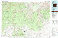
Elgin, OR maps
(8)- 1955 Map of Grangeville, 1964 Print
 1955 Grangeville1964 Print · USGSThe high country of the Idaho-Oregon border comes alive in the mid-1950s, showing the deep river canyons and mountain peaks. Trace the Union Pacific RR through the valleys or locate settlements like Grangeville, Joseph, and the shoreline of Wallowa Lake.4 unique versions available
 - 1959 Map of Grangeville
 1959 Grangeville1959 Print · USGSThe high alpine peaks and deep river canyons of the Idaho-Oregon borderlands are captured in the late fifties. Researchers can trace the Union Pacific RR through the valleys to settlements like Enterprise, Union, and Grangeville.2 unique versions available
 - 1964 Map of Elgin, 1966 Print
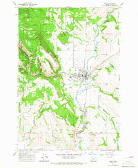 1964 Elgin1966 Print · USGSElgin and the surrounding Indian Valley are captured in the mid-sixties as a vital hub for the Union Pacific and the regional timber economy. Researchers can locate family landmarks like Galloway Cemetery and Bennetts Point, or trace historic routes such as the Fish Trap Grade.2 unique versions available
 - 1982 Map of Wallowa, 1983 Print
 1982 Wallowa1983 Print · USGSNortheast Oregon's rugged canyon country is captured here in the early eighties, showing a landscape defined by the Grande Ronde River and its high plateaus. Researchers can trace the Union Pacific line through Rondowa or locate vanished sites like Maxville and Palmer Junction.2 unique versions available
 - 2011 Map of Elgin, 2011 Print
 2011 Elgin2011 Print · USGSCovers Elgin, including Union County, United States, and other nearby areas
 - 2014 Map of Elgin, 2014 Print
 2014 Elgin2014 Print · USGSCovers Elgin, including Union County, United States, and other nearby areas
 - 2020 Map of Elgin, 2020 Print
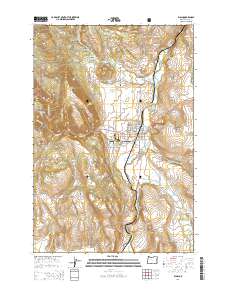
 2020 Elgin2020 Print · USGSCovers Elgin, including Union County, United States, and other nearby areas
 - 2023 Map of Elgin, 2023 Print
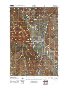
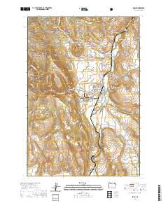
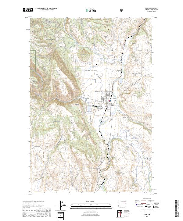 2023 Elgin2023 Print · USGSElgin and the Grande Ronde River valley are captured in this recent survey, showcasing the town's intersection with the high Oregon terrain. Genealogists and researchers can locate family burial sites like Jacob Long Cem and Indian Creek Cem or trace landmarks such as Hulse Airstrip.
End of results
Showing maps 1-8 of 8
Top cities near Elgin
- La Grande historical maps
- Island City historical maps
- Imbler historical maps
- Summerville historical maps
Frequently asked questions
- What are the different types of historical maps available for Elgin?
- What is the oldest map of Elgin?
- Where can I purchase historical maps of Elgin for my home or office?
- Where can I download high-res historical maps of Elgin?
- Are there historical topographic maps available for Elgin?
- Is there historical aerial imagery available for Elgin?
- Where are historical maps of Elgin sourced from?