Old Maps of Summerville, Oregon
Explore 19 old maps of Summerville, spanning from 1906 to today. These high-resolution historic maps reveal how streets, neighborhoods, landmarks, and natural features evolved over time — perfect for genealogy, metal detecting, research, and local history exploration.
What you can do with these maps:
- See how Summerville changed over time: Compare historical maps to modern-day views to trace roads, homesites, rail lines & more.
- View detailed metadata: Each map includes creators, publishers, year, scale, and archive source.
- Overlay maps with satellite & LiDAR: Visualize the past alongside modern tools to explore terrain & human change.
- Trusted historical sources: Maps sourced from the USGS, Library of Congress, and other archives.
- Access maps your way: View online, download high-res files, or order prints for personal or research use.
Start exploring old maps of Summerville to uncover forgotten places, hidden landmarks, and the deep history beneath your feet.
Summerville, OR maps
(19)- 1906 Map of Telocaset
 1906 Telocaset1906 Print · USGSEastern Oregon at the peak of its railroad and ranching era features a landscape of thriving valley towns and high forest reserves. Genealogists and local historians can trace early settlements like Union and Cove, or locate long-standing landmarks such as Hot Lake and Medical Springs.3 unique versions available
 - 1953 Map of Pendleton, 1957 Print
 1953 Pendleton1957 Print · USGSNortheastern Oregon and the Columbia River frontier are captured here in the early fifties, a time of massive federal infrastructure projects. Researchers can trace the historic route of The Old Oregon Trail as it passes near the Umatilla Ordnance Depot and the new McNary Dam.4 unique versions available
 - 1955 Map of Grangeville, 1964 Print
 1955 Grangeville1964 Print · USGSThe high country of the Idaho-Oregon border comes alive in the mid-1950s, showing the deep river canyons and mountain peaks. Trace the Union Pacific RR through the valleys or locate settlements like Grangeville, Joseph, and the shoreline of Wallowa Lake.4 unique versions available
 - 1956 Map of Pendleton
 1956 Pendleton1956 Print · USGSNortheastern Oregon’s high plateau and timbered peaks appear here in the mid-fifties, during a time of major military and hydroelectric development. Trace the path of The Old Oregon Trail alongside modern landmarks like McNary Dam and the Umatilla Ordnance Depot.
 - 1959 Map of Grangeville
 1959 Grangeville1959 Print · USGSThe high alpine peaks and deep river canyons of the Idaho-Oregon borderlands are captured in the late fifties. Researchers can trace the Union Pacific RR through the valleys to settlements like Enterprise, Union, and Grangeville.2 unique versions available
 - 1963 Map of Summerville, 1966 Print
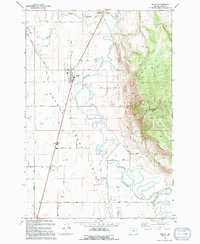
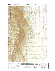
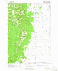 1963 Summerville1966 Print · USGSThe Grande Ronde Valley and the Blue Mountains meet in this Oregon study from the early sixties. Researchers can trace the area's rural development through the Pioneer Monument, the Grange Hall, and high-altitude landmarks like the Mt Emily Lookout Tower.2 unique versions available
 - 1965 Map of Imbler, 1967 Print
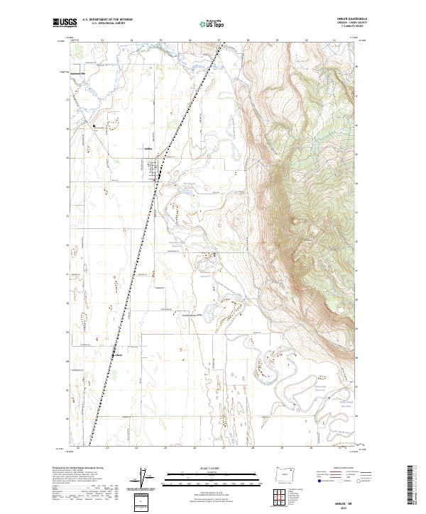
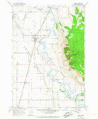 1965 Imbler1967 Print · USGSThe Grande Ronde Valley in the 1960s was a landscape defined by the winding Grande Ronde River and the vital Union Pacific rail line. Researchers can trace the layout of small farming communities like Summerville, Imbler, and Alicel, alongside family-named landmarks like Gaskell Lane.2 unique versions available
 - 1979 Map of La Grande, 1980 Print
 1979 La Grande1980 Print · USGSNorthwestern Oregon’s mountain corridors are captured here in the late seventies, showing the rail and river networks through the Blue Mountains. Trace the Old Emigrant Road, locate the Aurelia Mine, or explore the Starkey Experimental Forest.2 unique versions available
 - 1986 Map of Enterprise, 1987 Print
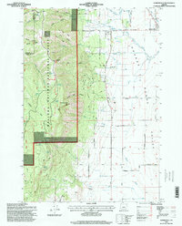
 1986 Enterprise1987 Print · USGSThe high peaks and deep valleys of Northeast Oregon are captured in the mid-1980s, showcasing the transition from the Grande Ronde Valley to the wilderness. Researchers can trace the Union Pacific rail corridor through Telocaset or locate historic sites like Cornucopia and Medical Springs.
 - 1994 Map of Imbler
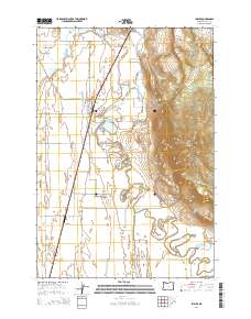
 1994 Imbler1994 Print · USGSSettlement in the Grande Ronde Valley was well-established by the late twentieth century, centered on farming hubs and river management. Researchers can trace family history through the Summerville Cem or explore the rural development around Imbler, Rhinehart, and Alicel.
 - 1996 Map of Summerville, 1998 Print
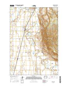
 1996 Summerville1998 Print · USGSNortheastern Oregon's agricultural heartland meets the timbered uplands in the mid-nineties. Researchers can trace family ranch lands along Mc Kenzie Lane or locate landmarks like the Pleasant Grove Grange Hall and the Pioneer Monument.
 - 2011 Map of Imbler, 2011 Print
 2011 Imbler2011 Print · USGSCovers Summerville, including Imbler, Alicel, and other nearby areas
 - 2011 Map of Summerville, 2011 Print
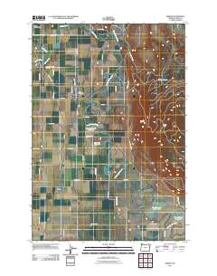
 2011 Summerville2011 Print · USGSCovers Summerville, including Umatilla County, Union County, and other nearby areas
 - 2014 Map of Summerville, 2014 Print
 2014 Summerville2014 Print · USGSCovers Summerville, including Umatilla County, Union County, and other nearby areas
 - 2014 Map of Imbler, 2014 Print
 2014 Imbler2014 Print · USGSCovers Summerville, including Imbler, Alicel, and other nearby areas
 - 2017 Map of Imbler, 2017 Print
 2017 Imbler2017 Print · USGSCovers Summerville, including Imbler, Alicel, and other nearby areas
 - 2020 Map of Summerville, 2020 Print
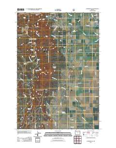
 2020 Summerville2020 Print · USGSCovers Summerville, including Umatilla County, Union County, and other nearby areas
 - 2023 Map of Imbler, 2023 Print
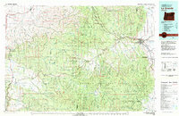
 2023 Imbler2023 Print · USGSThe Grande Ronde Valley's agricultural heritage and complex water systems are on full display in this recent survey of Union County. Researchers can trace family history through the Summerville Cem and numerous named water features like Ruckman Reservoir and Fleets Loop Reservoir.
 - 2024 Map of Summerville, 2024 Print
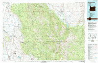
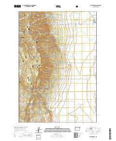
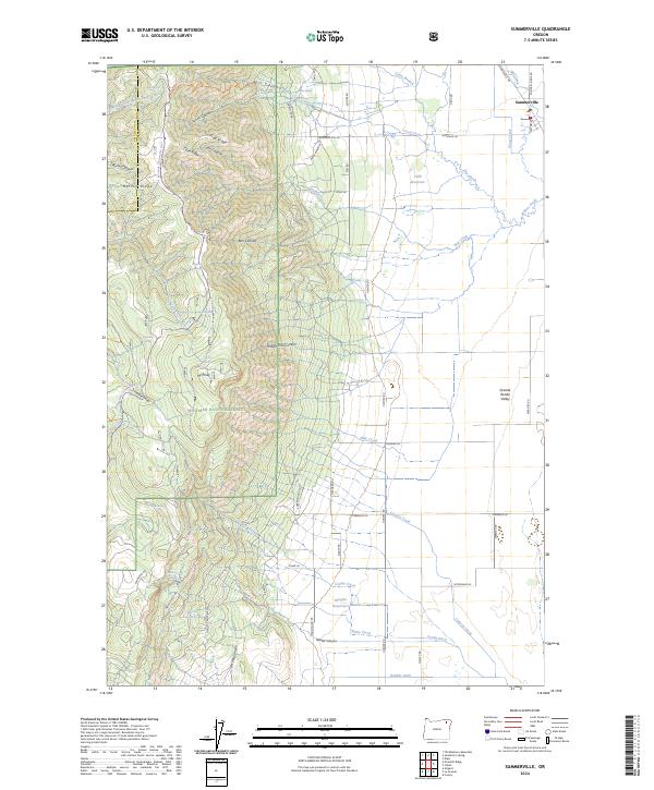 2024 Summerville2024 Print · USGSThe northern edge of the Grande Ronde Valley meets the Blue Mountains in the early twenty-first century, showing the enduring agricultural and timber character of Union County. Genealogists and hikers can trace old routes like Summerville Road and identify landmarks from Mt Emily to the curiously named Fiddlers Hell.
End of results
Showing maps 1-19 of 19
Top cities near Summerville
- La Grande historical maps
- Elgin historical maps
- Island City historical maps
- Cove historical maps
- Imbler historical maps
Frequently asked questions
- What are the different types of historical maps available for Summerville?
- What is the oldest map of Summerville?
- Where can I purchase historical maps of Summerville for my home or office?
- Where can I download high-res historical maps of Summerville?
- Are there historical topographic maps available for Summerville?
- Is there historical aerial imagery available for Summerville?
- Where are historical maps of Summerville sourced from?