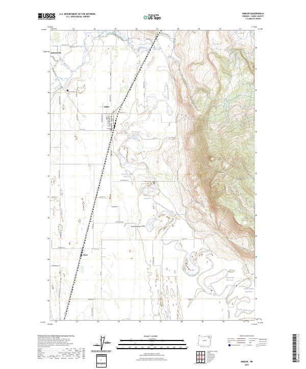
2023 Map of Imbler
USGS Topo · Published 2023About this map
The Grande Ronde Valley forms the heart of this landscape, where agricultural land meets the steep western slopes of Mt Harris. The settlement of Imbler serves as a central hub, flanked by the smaller communities of Summerville to the northwest and Alicel to the south. This region is characterized by a sophisticated water management system designed for the valley's fertile soils, featuring the Grande Ronde River, the State Ditch, and numerous family-named irrigation projects such as the Bill Howell Reservoir and Arnoldus Loop Reservoir.
Find a feature on this map
49 named features on this map. Tap any name to fly to it.
Don’t see what you’re looking for? This feature index may not catch every label — zoom into the map to look around manually.
Map Details
Editions of this 2023 Imbler Map
This is the sole edition of this map. No revisions or reprints were ever made.
Other maps of this area

1906 · Telocaset
USGS Topo · 1:125,000

1953 · Pendleton
USGS Topo · 1:250,000

1955 · Grangeville
USGS Topo · 1:250,000

1956 · Pendleton
USGS Topo · 1:250,000

1959 · Grangeville
USGS Topo · 1:250,000

1963 · La Grande SE
USGS Topo · 1:24,000

1963 · Sanderson Spring
USGS Topo · 1:24,000

1963 · Summerville
USGS Topo · 1:24,000

1964 · Cricket Flat
USGS Topo · 1:24,000

1964 · Elgin
USGS Topo · 1:24,000