
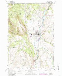
1964 Map of Elgin
USGS Topo · Published 1966About this map
Indian Valley serves as the focal point for this mid-1960s survey, where the Grande Ronde River and the Union Pacific railroad corridor intersect at the town of Elgin. The town is depicted with its local infrastructure intact, including the High Sch, a Grange Hall, and the Rodeo Grounds near Phillips Creek. The landscape transition is stark between the valley floor and the wooded heights of the Umatilla National Forest to the west, where timber and terrain are marked by features like Pumpkin Ridge and West Mountain. This map captures the region's agricultural and transit-based economy before significant modern expansion, preserving the locations of numerous family-named landmarks such as Galloway Cemetery and McCue Spring. The inclusion of the Fish Trap Grade and several jeep trails suggests a landscape heavily used for both resource extraction and local transit during this era.
Find a feature on this map
49 named features on this map. Tap any name to fly to it.
Don’t see what you’re looking for? This feature index may not catch every label — zoom into the map to look around manually.
Map Details
Editions of this 1964 Elgin Map
2 editions found
Other maps of this area

1906 · Telocaset
USGS Topo · 1:125,000

1953 · Pendleton
USGS Topo · 1:250,000

1955 · Grangeville
USGS Topo · 1:250,000

1956 · Pendleton
USGS Topo · 1:250,000

1959 · Grangeville
USGS Topo · 1:250,000

1963 · Andies Prairie
USGS Topo · 1:24,000

1963 · Sanderson Spring
USGS Topo · 1:24,000

1963 · Summerville
USGS Topo · 1:24,000

1964 · Partridge Creek
USGS Topo · 1:24,000

1964 · Cricket Flat
USGS Topo · 1:24,000