
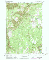
1964 Map of Partridge Creek
USGS Topo · Published 1965About this map
Umatilla National Forest dominates this mid-1960s landscape, where steep canyons and timbered slopes define the geography of Union County. The settlement at Palmer Junction serves as the primary focal point of human activity, complete with the Palmer Junction Sch and a nearby Gravel Pit. Drainage patterns are intricate, led by the Grande Ronde River in the southeast and complemented by the North Fork and South Fork as they carve through the high country.
Find a feature on this map
26 named features on this map. Tap any name to fly to it.
Don’t see what you’re looking for? This feature index may not catch every label — zoom into the map to look around manually.
Map Details
Editions of this 1964 Partridge Creek Map
2 editions found
Other maps of this area

1953 · Pendleton
USGS Topo · 1:250,000

1955 · Grangeville
USGS Topo · 1:250,000

1956 · Pendleton
USGS Topo · 1:250,000

1959 · Grangeville
USGS Topo · 1:250,000

1963 · Andies Prairie
USGS Topo · 1:24,000

1963 · Sanderson Spring
USGS Topo · 1:24,000

1963 · Tollgate
USGS Topo · 1:24,000

1964 · Cricket Flat
USGS Topo · 1:24,000

1964 · Elgin
USGS Topo · 1:24,000

1964 · Rondowa
USGS Topo · 1:24,000