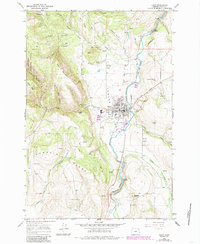
1964 Map of Elgin
USGS Topo · Published 1985About this map
Elgin serves as the focal point of this Union County survey, situated at the confluence of the Grande Ronde River and Indian Creek. The town's layout reflects its dual role as a local service hub and a station on the Union Pacific railroad, featuring a High Sch, the local Grange Hall, and dedicated Rodeo Grounds along the riverbanks. The surrounding geography is defined by a series of steep ridges and canyons, including the prominent West Mountain to the west and Pumpkin Ridge to the south.
Find a feature on this map
47 named features on this map. Tap any name to fly to it.
Don’t see what you’re looking for? This feature index may not catch every label — zoom into the map to look around manually.
Map Details
Editions of this 1964 Elgin Map
2 editions found

Other maps of this area

1906 · Telocaset
USGS Topo · 1:125,000

1953 · Pendleton
USGS Topo · 1:250,000

1955 · Grangeville
USGS Topo · 1:250,000

1956 · Pendleton
USGS Topo · 1:250,000

1959 · Grangeville
USGS Topo · 1:250,000

1963 · Andies Prairie
USGS Topo · 1:24,000

1963 · Sanderson Spring
USGS Topo · 1:24,000

1963 · Summerville
USGS Topo · 1:24,000

1964 · Partridge Creek
USGS Topo · 1:24,000

1964 · Cricket Flat
USGS Topo · 1:24,000