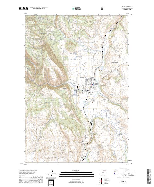
2023 Map of Elgin
USGS Topo · Published 2023About this map
The Grande Ronde River flows through the heart of this Union County landscape, defining the layout of Elgin and the surrounding agricultural Indian Valley. This modern survey illustrates the town's grid, centered around streets like Baltimore St and Alder St, and its proximity to industrial and transport features like the Elgin-Mill Wastewater Lagoon and Hulse Airstrip. Beyond the valley floor, the terrain rises sharply into named elevations including South Mtn and West Mtn, dissected by drainages like Phillips Creek and Gordon Creek. For those tracing family histories, several burial sites are clearly marked, including Jacob Long Cem to the north and the larger Elgin Cem to the east. The map also captures small-scale water management features such as Merritt Reservoir and numerous named springs, reflecting the vital relationship between the local geography and the region's water resources.
Find a feature on this map
71 named features on this map. Tap any name to fly to it.
Don’t see what you’re looking for? This feature index may not catch every label — zoom into the map to look around manually.
Map Details
Editions of this 2023 Elgin Map
This is the sole edition of this map. No revisions or reprints were ever made.
Other maps of this area

1906 · Telocaset
USGS Topo · 1:125,000

1953 · Pendleton
USGS Topo · 1:250,000

1955 · Grangeville
USGS Topo · 1:250,000

1956 · Pendleton
USGS Topo · 1:250,000

1959 · Grangeville
USGS Topo · 1:250,000

1963 · Andies Prairie
USGS Topo · 1:24,000

1963 · Sanderson Spring
USGS Topo · 1:24,000

1963 · Summerville
USGS Topo · 1:24,000

1964 · Partridge Creek
USGS Topo · 1:24,000

1964 · Cricket Flat
USGS Topo · 1:24,000