1900s (20th Century) Maps of Armstrong County, Pennsylvania
Explore 64 historic maps of Armstrong County from the 1900s (20th Century). These maps offer a rare glimpse into what life looked like during the 1900s — showing old roads, neighborhoods, homes, and landmarks that have changed or disappeared over time.
Whether you're researching your family's past, planning a metal detecting trip, or studying how Armstrong County's landscape evolved across the 1900s, these high-resolution maps are a powerful tool for exploring the history of this region.
- Focus on a specific era: All maps on this page are from the 1900s, giving you a focused view of this time period.
- See what’s changed: Compare century-old streets, trails, and buildings to today's modern landscape using overlays and satellite layers.
- Research with precision: Use these maps for genealogy, historical research, land use analysis, or educational projects.
- View, download, or print: Maps are fully viewable online in high resolution, and can be downloaded or printed for your own records.
Start exploring Armstrong County's history through authentic maps from the 1900s. This is your window into the past.
Armstrong County, PA maps
(64)- 1900 Map of Kittanning, 1963 Print
 1900 Kittanning1963 Print · USGSThe Allegheny River valley was a bustling corridor of rail and river industry at the turn of the century. Genealogists and researchers can trace family landmarks and early industrial sites like Redbank Furnace, Laceys Store, and Buffalo Mills.
 - 1901 Map of Rural Valley, 1957 Print
 1901 Rural Valley1957 Print · USGSArmstrong County’s river valleys and iron-working hamlets are captured here at the start of the twentieth century. Researchers can trace the legacy of early industry at Mahoning Furnace or follow the path of the Pennsylvania R.R. through Templeton.2 unique versions available
 - 1902 Map of Kittanning
 1902 Kittanning1902 Print · USGSThe Allegheny River corridor at the start of the twentieth century shows a region shaped by heavy rail and early industry. Trace family roots and old commercial sites like Redbank Furnace, East Brady, and the milling hub at Worthington.6 unique versions available
 - 1902 Map of Indiana
 1902 Indiana1902 Print · USGSIndiana County at the turn of the century shows a landscape of growing rail towns and rural farmsteads connected by the Pennsylvania Railroad. Researchers can trace ancestral roots through vanished crossroads and early industrial sites like Homer, Mechanicsburg, and Graceton.8 unique versions available
 - 1902 Map of Elders Ridge, 1957 Print
 1902 Elders Ridge1957 Print · USGSWestern Pennsylvania at the turn of the century reveals a landscape of deep valleys and rising industrial rail lines. Genealogists can trace family roots through rural hubs like Brick Church, Elderton, and the namesake village of Elders Ridge.2 unique versions available
 - 1903 Map of Rural Valley
 1903 Rural Valley1903 Print · USGSArmstrong County at the dawn of the twentieth century shows a landscape defined by iron furnaces and winding river valleys. Genealogists can trace family roots in early settlements like Templeton, Goheenville, and Putneyville or locate landmarks such as Mahoning Furnace and Stone House.6 unique versions available
 - 1904 Map of Elders Ridge
 1904 Elders Ridge1904 Print · USGSArmstrong and Indiana Counties are shown here during the early 1900s, when the river-and-rail economy dominated the valley floor. Researchers can trace ancestral roots through rural hamlets like Elders Ridge, Cochran Mills, and Shelocta, or follow the Western Pennsylvania Division (P. R. R.) along the Kiskiminitas River.5 unique versions available
 - 1906 Map of Clarion
 1906 Clarion1906 Print · USGSClarion County at the turn of the century is defined by its deep river valleys and a bustling network of narrow-gauge railroads and coal mines. Genealogists and historians can trace dozens of rural schoolhouses and churches, from Concord Church to the Burma (Five Points) School and the early mines of Rimersburg.2 unique versions available
 - 1907 Map of Clarion
 1907 Clarion1907 Print · USGSClarion County at the dawn of the twentieth century shows a landscape shaped by coal mining and a complex rail network. Genealogists can locate specific family landmarks like Acme Mines, Concord Church, and rural outposts such as Limestone P.O..5 unique versions available
 - 1907 Map of Foxburg, 1953 Print
 1907 Foxburg1953 Print · USGSThe river-and-rail economies of Clarion and Armstrong counties are on full display in this early 1900s survey. Genealogists and industrial historians can trace vanished post offices like Perryville Pollock PO, early iron works at Canoe Furnace, and the riverside tracks of the Pennsylvania railroad.2 unique versions available
 - 1907 Map of Freeport, 1956 Print
 1907 Freeport1956 Print · USGSThe industrial river valleys of Armstrong, Westmoreland, and Butler counties come alive in this early 1900s survey. Genealogists and researchers can trace the rail-and-river network through Freeport and Schenley, locating old post offices at Garvers Ferry and Dime.
 - 1908 Map of Foxburg
 1908 Foxburg1908 Print · USGSThe Pennsylvania river valleys thrive during the early twentieth-century industrial boom, as river traffic and railroads intersect in the heart of the coal and iron region. Researchers can locate early post offices at New Salem Lamartine PO, industrial sites like Sarah Furnace, and the Blue Goose Mine.5 unique versions available
 - 1909 Map of Smicksburg
 1909 Smicksburg1909 Print · USGSIndiana and Jefferson Counties are seen here in the early twentieth century as a complex network of small hamlets and emerging rail lines. Genealogists can trace family roots through specific landmarks like Motterns Mill, Mt Zion Church, and the dual-named New Salem Pierce PO.2 unique versions available
 - 1909 Map of Freeport
 1909 Freeport1909 Print · USGSThe industrial river valleys of the Allegheny and Kiskiminitas are captured here during the peak of Pennsylvania's rail-and-river era. Researchers can trace the early layouts of Freeport and Leechburg or locate vanished sites like the Lucesco PO.5 unique versions available
 - 1924 Map of Brookville, 1957 Print
 1924 Brookville1957 Print · USGSJefferson County in the early 1920s is captured here at a peak of rural development, showing a landscape defined by rail lines and small creek-side settlements. Genealogists can locate dozens of country schools and churches, from Mead Chapel to the Smith School and Ramsaytown.2 unique versions available
 - 1926 Map of Brookville
 1926 Brookville1926 Print · USGSJefferson County at the peak of its rail-and-river industrial era is captured in this survey of the northern coalfields. Genealogists and historians can trace family land near Brookville or locate vanished rural schoolhouses like Hazel Dell School and Mead Chapel.3 unique versions available
 - 1938 Map of Smicksburg, 1965 Print
 1938 Smicksburg1965 Print · USGSThe rural valleys of western Pennsylvania are captured here just before the Second World War, showing a network of railroad towns and agricultural hubs. Researchers can trace the lineage of local landmarks like Mottarns Mill, Glade Run Ch, and the many one-room schoolhouses such as Schranger Sch.
 - 1939 Map of Smicksburg
 1939 Smicksburg1939 Print · USGSBefore the mid-century industrial shifts, this part of rural Pennsylvania was a busy landscape of township schools and creek-side rail stops. Genealogists can trace early homesteads near Smicksburg, Moffatts Mill, and Gilgal Ch.2 unique versions available
 - 1944 Map of Brookville
 1944 Brookville1944 Print · USGSThe Jefferson and Clarion County borderlands come alive in the 1940s, showing a landscape defined by river-valley railroads and rural school districts. Researchers can trace the lineage of local communities through landmarks like Mead Chapel, the mining works at Conifer, and old post offices in Worthville or Markton.
 - 1949 Map of Brookville
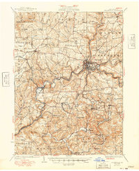 1949 Brookville1949 Print · USGSJefferson County settlement at the end of the 1940s centers on the river junctions and rail lines near Brookville. Genealogists can trace family footprints across dozens of country schoolhouses like Oaks School and villages like Summerville or Knoxdale.
 - 1953 Map of Pittsburgh
 1953 Pittsburgh1953 Print · USGSWestern Pennsylvania's industrial landscape at the start of the fifties shows the steel and rail corridors between Pittsburgh and Altoona. Trace family roots in river towns like Tarentum or follow the Pennsylvania Turnpike across Laurel Hill.
 - 1953 Map of Vandergrift, 1955 Print
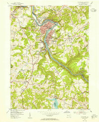 1953 Vandergrift1955 Print · USGSThe Kiskiminetas Valley in the early fifties shows a bustling industrial landscape of riverfront rail and hilltop mining. Locate family history at the Saints Cosmas & Damian Shrine, Pleasant Hill Cemetery, or the Washington Twp High Sch.4 unique versions available
 - 1953 Map of Freeport, 1955 Print
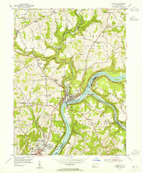 1953 Freeport1955 Print · USGSThe confluence of the Allegheny and Kiskiminetas rivers defines this mid-century industrial corridor. Trace the rail-and-river economy through Schenley, Butler Junction, and the vanished site of Garvers Ferry.4 unique versions available
 - 1954 Map of Pittsburgh
 1954 Pittsburgh1954 Print · USGSWestern Pennsylvania in the early fifties remains a powerhouse of heavy industry and vital transit corridors. Genealogists and historians can trace the rail-and-river network connecting Pittsburgh, Johnstown, and Altoona via the Pennsylvania RR and the Lincoln Highway.2 unique versions available
 - 1954 Map of Leechburg, 1956 Print
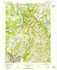 1954 Leechburg1956 Print · USGSThe confluence of the Allegheny and Kiskiminetas rivers defines this mid-century industrial corridor. Genealogists can trace family names at Oakland Cem and locate community anchors like Rogers Chapel or Kelly Station.5 unique versions available
Showing maps 1-25 of 64
Top cities of Armstrong County
- Kittanning historical maps
- Ford City historical maps
- North Buffalo Township historical maps
- Leechburg historical maps
- Freeport historical maps
- West Kittanning historical maps
See more
Frequently asked questions
- What are the different types of historical maps available for Armstrong County?
- What is the oldest map of Armstrong County?
- Where can I purchase historical maps of Armstrong County for my home or office?
- Where can I download high-res historical maps of Armstrong County?
- Are there historical topographic maps available for Armstrong County?
- Is there historical aerial imagery available for Armstrong County?
- Where are historical maps of Armstrong County sourced from?