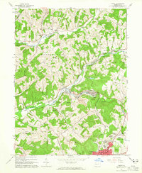
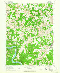
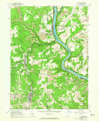
1960s Maps of Armstrong County, Pennsylvania
Explore 20 historic maps of Armstrong County from the 1960s. These maps offer a rare glimpse into what life looked like during the 1960s — showing old roads, neighborhoods, homes, and landmarks that have changed or disappeared over time.
Whether you're researching your family's past, planning a metal detecting trip, or studying how Armstrong County's landscape evolved across the 1960s, these high-resolution maps are a powerful tool for exploring the history of this region.
- Focus on a specific era: All maps on this page are from the 1960s, giving you a focused view of this time period.
- See what’s changed: Compare century-old streets, trails, and buildings to today's modern landscape using overlays and satellite layers.
- Research with precision: Use these maps for genealogy, historical research, land use analysis, or educational projects.
- View, download, or print: Maps are fully viewable online in high resolution, and can be downloaded or printed for your own records.
Start exploring Armstrong County's history through authentic maps from the 1960s. This is your window into the past.
Armstrong County, PA maps
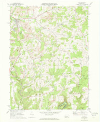
(20)- 1963 Map of East Brady, 1964 Print
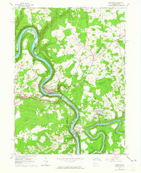
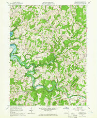
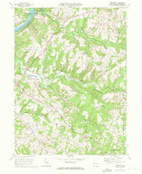
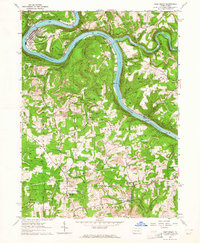 1963 East Brady1964 Print · USGSThe Allegheny River corridor in the early sixties was a hub of rail transport and strip mining across the Clarion and Armstrong county lines. Local historians can trace the foundations of East Brady and Philipston, or locate rural landmarks like St Eusebius Ch and Lock and Dam No 9.2 unique versions available
 - 1963 Map of Ernest, 1965 Print
 1963 Ernest1965 Print · USGSIndiana County was a hub of coal and rail activity in the 1960s, centered on the growing northern suburbs of Indiana. Researchers can trace historic industrial sites like the Mina Dump or locate ancestral sites such as Old Washington Cem and Harmony Grove Ch.4 unique versions available
 - 1963 Map of Rimersburg, 1965 Print
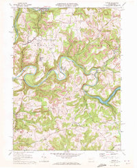
 1963 Rimersburg1965 Print · USGSThe border of Clarion and Armstrong counties comes alive in the early sixties as a region of river bends and industrial tradition. Genealogists can trace family roots through Sarah Furnace, Kissingers Mill, and rural sites like Robinson Cem and Concord Ch.3 unique versions available
 - 1963 Map of Parker, 1965 Print
 1963 Parker1965 Print · USGSThe river-and-rail corridor of northern Armstrong and Butler counties is captured here in the early sixties, showing an active landscape of energy extraction. Genealogists and historians can locate family landmarks such as Bear Creek Cemetery or Griswell Ch and trace the rail path through Petrolia and Bruin.5 unique versions available
 - 1963 Map of Emlenton, 1965 Print
 1963 Emlenton1965 Print · USGSThe Allegheny and Clarion rivers converge in the early 1960s, creating a hub of rail activity and resource extraction. Genealogists and historians can trace the numerous oil wells and strip mines surrounding communities like St Petersburg, Emlenton, and Foxburg.4 unique versions available
 - 1964 Map of Pittsburgh
 1964 Pittsburgh1964 Print · USGSWestern Pennsylvania in the late fifties and early sixties shows a landscape of powerful river industries and expanding highways. Genealogists and historians can trace the rail corridors of the Pennsylvania RR through industrial hubs like Johnstown, Altoona, and Nanty Glo.
 - 1964 Map of Chicora, 1965 Print
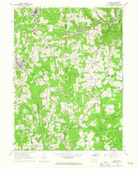 1964 Chicora1965 Print · USGSAcross Butler and Armstrong counties in the mid-sixties, this area reveals a landscape shaped by mining and rail. Genealogists can trace family names and landmarks like White Oak Cem, Kepples Corners, and the old Home for the Aged.3 unique versions available
 - 1964 Map of Avonmore, 1966 Print
 1964 Avonmore1966 Print · USGSThe coal and gas country of the Kiskiminetas valley is captured here in the mid-sixties as extraction and industry shaped local life. Researchers can trace the Pennsylvania Railroad through Avonmore and locate community landmarks like Elders Ridge Joint High Sch and Clarksburg Ch.4 unique versions available
 - 1964 Map of Elderton, 1966 Print
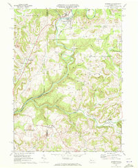
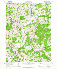 1964 Elderton1966 Print · USGSThe Armstrong and Indiana county border comes alive in the mid-sixties, showing a landscape of deep valleys and expanding gas fields. Researchers can locate family sites near Elderton, trace the Baltimore and Ohio line, or find Salem Ch and St Jacobs Ch.3 unique versions available
 - 1964 Map of Whitesburg, 1966 Print
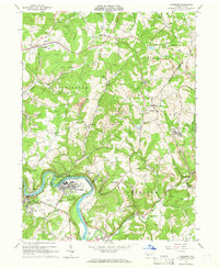
 1964 Whitesburg1966 Print · USGSArmstrong County in the mid-1960s was defined by winding waterways and a robust rural extraction economy. Genealogists and historians can trace the foundations of local communities like Brick Church, Whitesburg, and Cochrans Mills alongside numerous family-named cemeteries and gas wells.4 unique versions available
 - 1964 Map of Mc Intyre, 1966 Print
 1964 Mc Intyre1966 Print · USGSIndiana and Armstrong counties in the mid-sixties reveal a landscape defined by coal and gas extraction. Genealogists and historians can trace the rail-linked mining towns of Mc Intyre and Coal Run or locate the West Lebanon Cem and Ebenezer Ch.4 unique versions available
 - 1968 Map of Dayton, 1971 Print
 1968 Dayton1971 Print · USGSThe hills of Armstrong and Jefferson counties were deeply shaped by coal and rail during the late sixties. Researchers can trace the legacy of extractive industry and rural life through Strip Mines, the Dayton High Sch, and family landmarks like St James Cem.4 unique versions available
 - 1968 Map of Plumville, 1971 Print
 1968 Plumville1971 Print · USGSIndiana and Armstrong counties meet in this late 1960s survey of Pennsylvania's rolling plateau and creek valleys. Genealogists and historians can trace numerous rural burial sites like Sacred Heart Cem and industry markers such as Hoosicks Mill.3 unique versions available
 - 1968 Map of Mosgrove, 1972 Print
 1968 Mosgrove1972 Print · USGSArmstrong County in the late 1960s shows a landscape of rail-and-river transport and burgeoning energy extraction. Trace ancestral roots through rural sites like Rupp Cem, Pine Furnace, and the old Township Sch near Sunnyside.4 unique versions available
 - 1969 Map of Rural Valley, 1972 Print
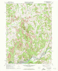
 1969 Rural Valley1972 Print · USGSArmstrong County's mining and gas-drilling heritage is on full display in the late sixties. Genealogists and historians can trace family roots near Rural Valley, NuMine, and Yatesboro, or locate rural churches like St Michaels Ch.3 unique versions available
 - 1969 Map of Distant, 1972 Print
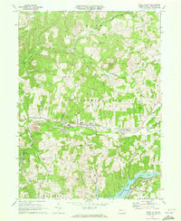
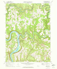
 1969 Distant1972 Print · USGSArmstrong County is shaped by heavy industry and deep river valleys in the late sixties, just as the regional landscape was being transformed by resource extraction. Genealogists can trace family roots through sites like Oakland Cem or Jerusalem Ch while following the path of the Penn Central through South Bethlehem.3 unique versions available
 - 1969 Map of Summerville, 1972 Print
 1969 Summerville1972 Print · USGSJefferson and Clarion counties are shown in the late sixties as the region's rail and mining industries shaped the landscape. Genealogists and historians can trace family locations near Summerville, Bethlehem Cem, and the Content schoolhouse.3 unique versions available
 - 1969 Map of Sligo, 1972 Print
 1969 Sligo1972 Print · USGSClarion County's extraction landscape is captured here in the late sixties, where rail lines and gas wells meet traditional rural hamlets. Local historians can trace the Penn Central tracks through Sligo or locate landmarks like Licking Ch and Squirrel Hill.3 unique versions available
 - 1969 Map of Templeton, 1972 Print
 1969 Templeton1972 Print · USGSArmstrong and Clarion Counties are mapped here in the late sixties, showing a landscape defined by mining and river commerce. Researchers can trace the rail paths of the Pittsburg and Shawmut, locate old Coke Ovens, and find family sites like Duncan Cem.4 unique versions available
 - 1969 Map of New Bethlehem, 1972 Print
 1969 New Bethlehem1972 Print · USGSThe Redbank Creek valley in the late 1960s was a bustling hub of rail and industry. Researchers can trace the legacy of the Gas Field and Strip Mine workings surrounding New Bethlehem, Hawthorn, and Fairmount City.2 unique versions available
End of results
Showing maps 1-20 of 20
Top cities of Armstrong County
- Kittanning historical maps
- Ford City historical maps
- North Buffalo Township historical maps
- Leechburg historical maps
- Freeport historical maps
- West Kittanning historical maps
See more
Frequently asked questions
- What are the different types of historical maps available for Armstrong County?
- What is the oldest map of Armstrong County?
- Where can I purchase historical maps of Armstrong County for my home or office?
- Where can I download high-res historical maps of Armstrong County?
- Are there historical topographic maps available for Armstrong County?
- Is there historical aerial imagery available for Armstrong County?
- Where are historical maps of Armstrong County sourced from?