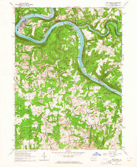
1963 Map of East Brady
USGS Topo · Published 1964About this map
The Allegheny River carves a dramatic oxbow through the borderlands of Clarion and Armstrong counties, defining the industrial and transit character of this region in the early 1960s. At the center of this bend, East Brady serves as a primary settlement, connected to the outer world by the Pennsylvania railroad line. The landscape is heavily marked by the region's extractive history, with numerous strip mines and gas wells scattered across the high ridges like Burnt Ridge. Navigation on the river is anchored by Lock and Dam No 9, while smaller communities like Philipston and Wattersonville dot the riverbanks. Rural life is evidenced by a network of local institutions, including Township Sch and several country churches such as St Marys Ch and St Marks Ch. The presence of the Baltimore and Ohio railroad near Adrian further illustrates the era's reliance on rail for moving coal and local resources.
Find a feature on this map
56 named features on this map. Tap any name to fly to it.
Don’t see what you’re looking for? This feature index may not catch every label — zoom into the map to look around manually.
Map Details
Editions of this 1963 East Brady Map
2 editions found
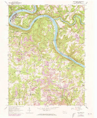
Other maps of this area

1900 · Kittanning
USGS Topo · 1:62,500

1901 · Rural Valley
USGS Topo · 1:62,500

1902 · Kittanning
USGS Topo · 1:62,500

1903 · Rural Valley
USGS Topo · 1:62,500

1906 · Clarion
USGS Topo · 1:62,500

1907 · Clarion
USGS Topo · 1:62,500

1907 · Foxburg
USGS Topo · 1:62,500

1908 · Foxburg
USGS Topo · 1:62,500

1953 · Pittsburgh
USGS Topo · 1:250,000

1954 · Pittsburgh
USGS Topo · 1:250,000