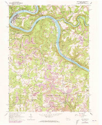
1963 Map of East Brady
USGS Topo · Published 1973About this map
Bradys Bend anchors this landscape where the Allegheny River carves a dramatic loop, defining the boundary between Armstrong and Clarion counties. The mid-century industrial footprint is evident through numerous strip mines and gas wells that dot the uplands of Brady and Madison townships. The Penn Central railroad corridor traces the riverbanks, serving riverside communities like East Brady, Philipston, and Rimer.
Find a feature on this map
45 named features on this map. Tap any name to fly to it.
Don’t see what you’re looking for? This feature index may not catch every label — zoom into the map to look around manually.
Map Details
Editions of this 1963 East Brady Map
2 editions found
Other maps of this area

1900 · Kittanning
USGS Topo · 1:62,500

1901 · Rural Valley
USGS Topo · 1:62,500

1902 · Kittanning
USGS Topo · 1:62,500

1903 · Rural Valley
USGS Topo · 1:62,500

1906 · Clarion
USGS Topo · 1:62,500

1907 · Clarion
USGS Topo · 1:62,500

1907 · Foxburg
USGS Topo · 1:62,500

1908 · Foxburg
USGS Topo · 1:62,500

1953 · Pittsburgh
USGS Topo · 1:250,000

1954 · Pittsburgh
USGS Topo · 1:250,000